Bay Springs - Thigpen Field
Airport details
| Country | United States of America |
| State | Mississippi |
| Region | K7 |
| Airspace | Memphis Ctr |
| Municipality | Bay Springs |
| Elevation | 351ft (107m) |
| Timezone | GMT -6 |
| Coordinates | 31.95375, -89.23534 |
| Magnetic var | |
| Type | land |
| Available since | X-Plane v10.40 |
| ICAO code | 00M |
| IATA code | n/a |
| FAA code | 00M |
Communication
| Thigpen Field CTAF | 122.900 |
Nearby Points of Interest:
Laurel Central Historic District
-Newell Rogers House
-Newton station
-Covington County Courthouse
-Quitman Depot
-Stuckey's Bridge
-Meridian Regional Airport
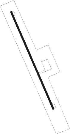
Runway info
| Runway 16 / 34 | ||
| length | 915m (3002ft) | |
| bearing | 158° / 338° | |
| width | 15m (50ft) | |
| surface | asphalt | |
Nearby beacons
| code | identifier | dist | bearing | frequency |
|---|---|---|---|---|
| LBY | EATON (HATTIESBURG) VORTAC | 32.5 | 191° | 110.60 |
| MEI | MERIDIAN VORTAC | 33.6 | 45° | 117 |
| EWA | DME | 46.7 | 62° | 113.80 |
| NMM | MERIDIAN TACAN | 51.3 | 48° | 111.90 |
| MHZ | MAGNOLIA (MADISON) VORTAC | 52.5 | 299° | 113.20 |
| JA | ALLEN (JACKSON) NDB | 52.7 | 297° | 365 |
| GCV | GREENE CO. (LEAKESVILLE) VORTAC | 64.1 | 139° | 115.70 |
Disclaimer
The information on this website is not for real aviation. Use this data with the X-Plane flight simulator only! Data taken with kind consent from X-Plane 12 source code and data files. Content is subject to change without notice.