Louisburg - North Raleigh
Airport details
| Country | United States of America |
| State | North Carolina |
| Region | |
| Airspace | Washington Ctr |
| Municipality | Franklin County |
| Elevation | 348ft (106m) |
| Timezone | GMT -5 |
| Coordinates | 36.08237, -78.37435 |
| Magnetic var | |
| Type | land |
| Available since | X-Plane v10.40 |
| ICAO code | 00NC |
| IATA code | n/a |
| FAA code | 00NC |
Communication
Nearby Points of Interest:
Green Hill House
-Franklin County Training School-Riverside Union School
-Cascine
-Fuller House
-Louisburg Historic District
-Dr. J. H. Harris House
-Williamson House
-Person Place
-Franklinton Depot
-Shemuel Kearney House
-Person-McGhee Farm
-Dr. Calvin Jones House
-Forestville Baptist Church
-Andrews-Moore House
-Capehart House
-Dr. Samuel Perry House
-Henderson Central Business Historic District
-Maria Parham Hospital
-Henderson Fire Station and Municipal Building
-Vance County Courthouse
-First National Bank Building
-Bennett Bunn Plantation
-Library and Laboratory Building-Henderson Institute
-George and Neva Barbee House
-Central Children's Home of North Carolina
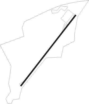
Runway info
| Runway 5 / 23 | ||
| length | 808m (2651ft) | |
| bearing | 48° / 228° | |
| width | 11m (36ft) | |
| surface | asphalt | |
Nearby beacons
| code | identifier | dist | bearing | frequency |
|---|---|---|---|---|
| HXO | HUNTSBORO (OXFORD) NDB | 17.6 | 312° | 271 |
| LE | LEEVY (RALEIGH/DURHAM) NDB | 19.2 | 246° | 350 |
| RDU | RALEIGH-DURHAM VORTAC | 23.5 | 243° | 117.20 |
| TYI | TAR RIVER (ROCKY MOUNT) VORTAC | 33.1 | 99° | 117.80 |
| HUR | PERSON (ROXBORO) NDB | 34.7 | 282° | 220 |
| JN | JURLY (SMITHFIELD) NDB | 36.5 | 185° | 263 |
| HQT | HARNETT (ERWIN) NDB | 41.6 | 205° | 417 |
| SBV | SOUTH BOSTON VORTAC | 47.1 | 313° | 110.40 |
| GSB | SEYMOUR JOHNSON TACAN | 48.9 | 152° | 116.50 |
| LVL | LAWRENCEVILLE VORTAC | 49.7 | 33° | 112.90 |
| DAN | DANVILLE VOR | 54.9 | 297° | 113.10 |
| ISO | KINSTON VORTAC | 58.3 | 131° | 109.60 |
| POB | POPE (FAYETTEVILLE) NDB | 58.6 | 214° | 338 |
| IS | STALS (KINSTON) NDB | 60.1 | 141° | 276 |
| FGP | FORT BRAGG NDB | 60.5 | 205° | 393 |
| POB | POPE (FAYETTEVILLE) TACAN | 63.2 | 215° | 113.80 |
Disclaimer
The information on this website is not for real aviation. Use this data with the X-Plane flight simulator only! Data taken with kind consent from X-Plane 12 source code and data files. Content is subject to change without notice.