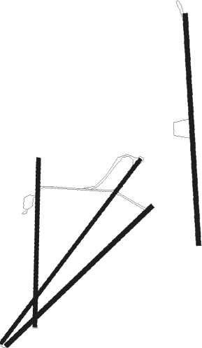
Frazier Park - Conover Air Lodge
Airport details
| Country | United States of America |
| State | California |
| Region | |
| Airspace | Los Angeles Ctr |
| Municipality | Ventura County |
| Elevation | 5160ft (1573m) |
| Timezone | GMT -8 |
| Coordinates | 34.75520, -119.06592 |
| Magnetic var | |
| Type | land |
| Available since | X-Plane v10.40 |
| ICAO code | 02CL |
| IATA code | n/a |
| FAA code | 02CL |
Communication
Nearby Points of Interest:
Fort Tejon
-Charles M. Pratt House
-Union Oil Company Building
-Ebell Club of Santa Paula
-George Washington Faulkner House
-Lakeview Gusher
-San Buenaventura Mission Aqueduct
-Saticoy Southern Pacific Railroad Depot
-Elizabeth Bard Memorial Hospital
-First Baptist Church of Ventura
-Emmanuel Franz House
-Feraud General Merchandise Store
-The Fort (Taft, California)
-Carpinteria
-Colony House (Simi, California)
-Pico Canyon Oilfield
-Joel McCrea Ranch
Runway info
Nearby beacons
| code | identifier | dist | bearing | frequency |
|---|---|---|---|---|
| GMN | GORMAN VORTAC | 10.5 | 77° | 116.10 |
| LHS | LAKE HUGHES VORTAC | 24.5 | 98° | 114.35 |
| FIM | FILLMORE VORTAC | 25.6 | 155° | 112.50 |
| CMA | CAMARILLO VOR/DME | 32.6 | 183° | 115.80 |
| RZS | SAN MARCUS (SANTA BARBARA VORTAC | 37.8 | 251° | 114.90 |
| NTD | POINT MUGU (OXNARD) TACAN | 38 | 185° | 110.60 |
| VTU | VENTURA (OXNARD) VOR/DME | 38.4 | 179° | 108.20 |
| VNY | VAN NUYS VOR/DME | 42.7 | 133° | 113.10 |
| EHF | SHAFTER (BAKERSFIELD) VORTAC | 43.8 | 358° | 115.40 |
| FLW | FELLOWS VOR/DME | 44.2 | 293° | 117.50 |
| SMO | SANTA MONICA VOR/DME | 53.9 | 141° | 110.80 |
| LAX | LOS ANGELES VORTAC | 58.5 | 142° | 113.60 |
| AVE | AVENAL VOR/DME | 69.8 | 314° | 117.10 |
Disclaimer
The information on this website is not for real aviation. Use this data with the X-Plane flight simulator only! Data taken with kind consent from X-Plane 12 source code and data files. Content is subject to change without notice.

