Sandy Valley - Kingston Ranch
Airport details
| Country | United States of America |
| State | California |
| Region | |
| Airspace | Los Angeles Ctr |
| Municipality | San Bernardino County |
| Elevation | 2620ft (799m) |
| Timezone | GMT -8 |
| Coordinates | 35.75805, -115.65359 |
| Magnetic var | |
| Type | land |
| Available since | X-Plane v10.40 |
| ICAO code | 04NV |
| IATA code | n/a |
| FAA code | 04NV |
Communication
| KINGSTON RANCH UNICOM | 123.000 |
Nearby Points of Interest:
Goodsprings Schoolhouse
-Sandstone Ranch
-Cima Dome & Volcanic Field National Natural Landmark
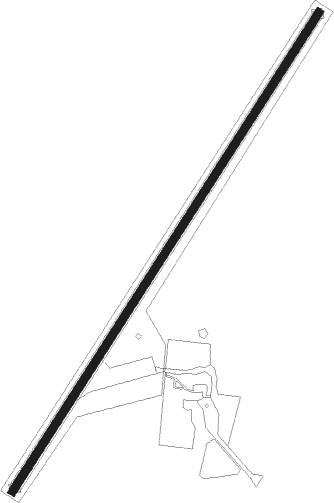
Runway info
| Runway 2 / 20 | ||
| length | 966m (3169ft) | |
| bearing | 43° / 223° | |
| width | 14m (45ft) | |
| surface | asphalt | |
Nearby beacons
| code | identifier | dist | bearing | frequency |
|---|---|---|---|---|
| GOG | DME | 11.2 | 49° | 112.05 |
| LAS | LAS VEGAS VORTAC | 30.8 | 57° | 116.90 |
| BLD | BOULDER CITY VORTAC | 41 | 73° | 116.70 |
| LSV | NELLIS (LAS VEGAS) TACAN | 42.2 | 52° | 135.50 |
| GFS | GOFFS VORTAC | 44.3 | 143° | 114.40 |
| INS | INDIAN SPRINGS TACAN | 49.6 | 359° | 114 |
| DAG | DAGGETT VORTAC | 65.8 | 229° | 113.20 |
| HEC | HECTOR VORTAC | 70 | 220° | 112.70 |
Disclaimer
The information on this website is not for real aviation. Use this data with the X-Plane flight simulator only! Data taken with kind consent from X-Plane 12 source code and data files. Content is subject to change without notice.