Griffith - Griffith Merrillville
Airport details
| Country | United States of America |
| State | Indiana |
| Region | K5 |
| Airspace | Chicago Ctr |
| Municipality | Griffith |
| Elevation | 632ft (193m) |
| Timezone | GMT -6 |
| Coordinates | 41.52185, -87.39701 |
| Magnetic var | |
| Type | land |
| Available since | X-Plane v10.40 |
| ICAO code | 05C |
| IATA code | n/a |
| FAA code | n/a |
Communication
| Griffith Merrillville CTAF/UNICOM | 123.000 |
| Griffith Merrillville CHICAGO Approach/Departure | 133.100 |
Nearby Points of Interest:
Griffith Grand Trunk Depot
-E.J. and E. Griffith Interlocking Tower
-Barney Sablotney House
-Morningside Historic District
-Jefferson Street Historic District
-Morgan-Skinner-Boyd Homestead
-Ibach House
-Lake County Tuberculosis Sanatorium, Nurses Home and Superintendent's House
-Louis J. Bailey Branch Library
-Meyer's Castle
-Combs Addition Historic District
-Lincoln Street Historic District
-Wilbur Wynant House
-Polk Street Concrete Cottage Historic District
-Eskilson Historic District
-Stallbohm Barn-Kaske House
-Morse Dell Plain House and Garden
-Polk Street Terraces Historic District
-Knights of Columbus Building
-Francis P. Keilman House
-American Sheet and Tin Mill Apartment Building
-Jackson-Monroe Terraces Historic District
-Monroe Terrace Historic District
-Emerson School for Visual and Performing Arts
-Union Station
Runway info
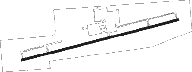
| Runway 8 / 26 | ||
| length | 1490m (4888ft) | |
| bearing | 82° / 262° | |
| width | 23m (75ft) | |
| surface | asphalt | |
| displ threshold | 0m (0ft) / 341m (1119ft) | |
Nearby beacons
| code | identifier | dist | bearing | frequency |
|---|---|---|---|---|
| GY | GARIE (GARY) NDB | 4.3 | 54° | 236 |
| CGT | CHICAGO HEIGHTS VORTAC | 7.8 | 266° | 114.20 |
| MX | KEDZI (CHICAGO) NDB | 18.6 | 307° | 248 |
| EON | PEOTONE VORTAC | 23.3 | 237° | 113.20 |
| VP | SEDLY (VALPARAISO) NDB | 23.7 | 98° | 212 |
| IKK | DME | 33.7 | 225° | 111.60 |
| OXI | KNOX VOR/DME | 35.7 | 105° | 115.60 |
| GCO | DME | 36.2 | 313° | 108.25 |
| IK | LUKOW (KANKAKEE) NDB | 37.9 | 225° | 272 |
| JOT | JOLIET VOR/DME | 41.4 | 272° | 112.30 |
| DPA | DUPAGE (CHICAGO) VOR/DME | 48.1 | 291° | 108.40 |
| OBK | NORTHBROOK VOR/DME | 48.7 | 322° | 113 |
| UG | WAUKE (CHICAGO/WAUKEGAN) NDB | 59.3 | 337° | 379 |
| BVT | BOILER (LAFAYETTE) VORTAC | 59.8 | 161° | 115.10 |
| RBS | ROBERTS VOR/DME | 66.2 | 219° | 116.80 |
Departure and arrival routes
| Transition altitude | 18000ft |
| Transition level | 18000ft |
| STAR starting points | distance | inbound heading | |
|---|---|---|---|
| ALL | |||
| LUCIT2 | 17.4 | 5° | |
| GSH7 | 61.5 | 270° | |
Instrument approach procedures
| runway | airway (heading) | route (dist, bearing) |
|---|---|---|
| RW08 | BOONE (308°) | BOONE FIPEX (22mi, 285°) 2300ft FIPEX (turn) 2300ft |
| RNAV | FIPEX 2300ft SOCOS (6mi, 82°) 2300ft 05C (6mi, 82°) 675ft (5288mi, 115°) 1034ft FIPEX (5299mi, 295°) 2300ft FIPEX (turn) | |
| RW26 | BOONE (308°) | BOONE REJMO (11mi, 360°) 2400ft |
| RW26 | CGT (86°) | CGT REJMO (17mi, 84°) 2400ft REJMO (turn) 2400ft |
| RNAV | REJMO 2400ft JASOL (6mi, 263°) 1700ft 05C (3mi, 264°) 664ft (5288mi, 115°) 1034ft REJMO (5279mi, 295°) 2400ft REJMO (turn) |
Holding patterns
| STAR name | hold at | type | turn | heading* | altitude | leg | speed limit |
|---|---|---|---|---|---|---|---|
| GSH7 | GSH | NDB | left | 92 (272)° | 1.0min timed | ICAO rules | |
| GSH7 | HALIE | VHF | left | 87 (267)° | 1.0min timed | ICAO rules | |
| GSH7 | IROCK | VHF | right | 87 (267)° | 1.0min timed | ICAO rules | |
| *) magnetic outbound (inbound) holding course | |||||||
Disclaimer
The information on this website is not for real aviation. Use this data with the X-Plane flight simulator only! Data taken with kind consent from X-Plane 12 source code and data files. Content is subject to change without notice.