Gladewater Tx - Gladewater Muni
Airport details
| Country | United States of America |
| State | Texas |
| Region | K4 |
| Airspace | Ft Worth Ctr |
| Municipality | Gladewater |
| Elevation | 292ft (89m) |
| Timezone | GMT -6 |
| Coordinates | 32.52883, -94.97175 |
| Magnetic var | |
| Type | land |
| Available since | X-Plane v10.40 |
| ICAO code | 07F |
| IATA code | n/a |
| FAA code | n/a |
Communication
| Gladewater Muni CTAF | 122.900 |
| Gladewater Muni LONGVIEW Approach/Departure | 118.250 |
Nearby Points of Interest:
Florence Robinson Cottage
-Cotton Belt Depot Museum
-Blackstone Building
-Elks Club Building
-People's National Bank Building
-William M. Steger Federal Building and United States Courthouse
-Jenkins-Harvey Super Service Station and Garage
-Carnegie Public Library
-St. James Colored Methodist Episcopal Church
-Marvin Methodist Episcopal Church, South
-Tyler City Hall
-Ramey House
-St. John's AF & AM Lodge
-Whitaker-McClendon House
-Henderson Commercial Historic District
-Howard L. and Vivian W. Lott House
-Pittsburg Commercial Historic District
-Marcus DeWitt Carlock House
-Fry-Barry House
-Arnot House
-Sam B. Hall, Jr. Federal Building and United States Courthouse
-Old Harrison County Courthouse
-James Turner House
-Ginocchio Historic District
-Hagerty House
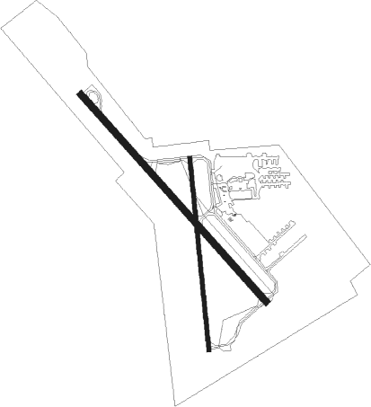
Runway info
Runway 14 / 32  | ||
| length | 1009m (3310ft) | |
| bearing | 138° / 318° | |
| width | 23m (75ft) | |
| surface | asphalt | |
| Runway 17 / 35 | ||
| length | 700m (2297ft) | |
| bearing | 179° / 359° | |
| width | 15m (50ft) | |
| surface | asphalt | |
Nearby beacons
| code | identifier | dist | bearing | frequency |
|---|---|---|---|---|
| ABG | AMBASSADOR (BIG SANDY) NDB | 7.9 | 292° | 404 |
| GG | VEELS (LONGVIEW) NDB | 9.8 | 113° | 410 |
| GGG | GREGG CO. (LONGVIEW) VORTAC | 12.9 | 117° | 112.90 |
| TYR | TYLER VOR/DME | 24.2 | 248° | 114.20 |
| UIM | DME | 29 | 312° | 114 |
| FZT | FRANKSTON VOR/DME | 39.3 | 231° | 111.40 |
| RPF | CARTHAGE NDB | 40.1 | 117° | 332 |
| SLR | SULPHUR SPRINGS VOR/DME | 49.4 | 320° | 109 |
| ATA | ATLANTA NDB | 52.4 | 54° | 347 |
| CSZ | CROSSROADS NDB | 57.3 | 245° | 215 |
| CZJ | AMASON (CENTER) NDB | 58.9 | 130° | 341 |
| TXK | TEXARKANA VORTAC | 74.4 | 42° | 116.30 |
Instrument approach procedures
| runway | airway (heading) | route (dist, bearing) |
|---|---|---|
| RW14 | GAVVN (138°) | GAVVN 2500ft |
| RW14 | LASSA (238°) | LASSA MAMRE (26mi, 264°) 2500ft GAVVN (7mi, 237°) 2500ft |
| RW14 | OTTIF (53°) | OTTIF AUNTY (16mi, 355°) 2500ft GAVVN (7mi, 57°) 2500ft |
| RNAV | GAVVN 2500ft ATWAT (5mi, 138°) 2200ft ZENOD (2mi, 138°) 2000ft WIPAN (3mi, 138°) 960ft 07F (2mi, 138°) 325ft (5657mi, 109°) 697ft GAVVN (5664mi, 289°) 2500ft GAVVN (turn) | |
| RW32 | NEVER (253°) | NEVER DANAY (13mi, 205°) 2500ft JOVOG (7mi, 237°) 2500ft |
| RW32 | OTTIF (53°) | OTTIF BOCAR (15mi, 101°) 2800ft JOVOG (7mi, 57°) 2500ft |
| RNAV | JOVOG 2500ft ZOBKO (7mi, 318°) 2000ft HANOF (3mi, 318°) 940ft 07F (2mi, 318°) 336ft (5657mi, 109°) 697ft GAVVN (5664mi, 289°) 2500ft GAVVN (turn) |
Disclaimer
The information on this website is not for real aviation. Use this data with the X-Plane flight simulator only! Data taken with kind consent from X-Plane 12 source code and data files. Content is subject to change without notice.