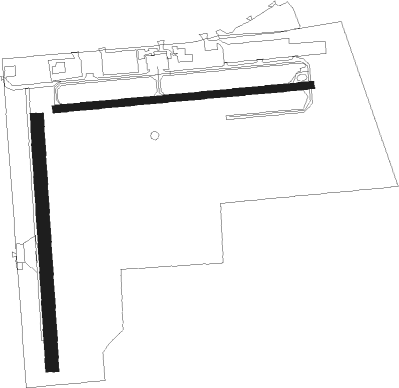
Elmore - Wetumpka Muni
Airport details
| Country | United States of America |
| State | Alabama |
| Region | K7 |
| Airspace | Atlanta Ctr |
| Municipality | Elmore County |
| Elevation | 194ft (59m) |
| Timezone | GMT -6 |
| Coordinates | 32.53075, -86.32787 |
| Magnetic var | |
| Type | land |
| Available since | X-Plane v10.40 |
| ICAO code | 08A |
| IATA code | n/a |
| FAA code | n/a |
Communication
| Wetumpka Muni CTAF/UNICOM | 123.050 |
| Wetumpka Muni MONTGOMERY Approach/Departure | 121.200 |
Nearby Points of Interest:
Fort Toulouse
-First Presbyterian Church of Wetumpka
-First United Methodist Church
-Wetumpka State Penitentiary
-Montgomery-Janes-Whittaker House
-Patrick Henry Brittan House
-Maxwell Air Force Base Senior Officers' Quarters Historic District
-Union Station
-Lower Commerce Street Historic District
-St. John's Episcopal Church
-Simler Hall
-Rice-Semple-Haardt House
-Building 800-Austin Hall
-Court Square Historic District
-Cassimus House
-Alabama State Capitol
-Bell Building
-William Lowndes Yancey Law Office
-Frank M. Johnson, Jr., Federal Building and United States Courthouse
-Cottage Hill Historic District
-Dowe Historic District
-Gov. Thomas G. Jones House
-Scott Street Firehouse
-Gerald-Dowdell House
-Jefferson Franklin Jackson House
Nearby beacons
| code | identifier | dist | bearing | frequency |
|---|---|---|---|---|
| MXF | MAXWELL (MONTGOMERY) TACAN | 9.3 | 195° | 115 |
| MG | MARRA (MONTGOMERY) NDB | 16 | 220° | 245 |
| MGM | MONTGOMERY VORTAC | 18.5 | 178° | 112.10 |
| TGE | TUSKEGEE VOR/DME | 33.4 | 94° | 117.30 |
| SE | POLLK (SELMA) NDB | 34.2 | 246° | 344 |
| TOI | BLOOD (TROY) NDB | 43.5 | 162° | 365 |
| OKW | BROOKWOOD VORTAC | 62.9 | 307° | 111 |
| BH | MCDEN (BIRMINGHAM) NDB | 64.4 | 332° | 224 |
Instrument approach procedures
| runway | airway (heading) | route (dist, bearing) |
|---|---|---|
| RW09 | HEMOV (89°) | HEMOV 3000ft |
| RW09 | RAXJO (70°) | RAXJO HEMOV (5mi, 359°) 3000ft |
| RW09 | SOSVE (108°) | SOSVE HEMOV (5mi, 179°) 3000ft |
| RNAV | HEMOV 3000ft COLJU (6mi, 89°) 2100ft TESQE (2mi, 89°) 1360ft 08A (4mi, 88°) 236ft (5219mi, 111°) 597ft TEQNU (5207mi, 291°) 3000ft TEQNU (turn) | |
| RW27 | JAVIV (289°) | JAVIV 3500ft TEQNU (5mi, 359°) 3000ft |
| RW27 | MIZXE (250°) | MIZXE 3000ft TEQNU (5mi, 179°) 3000ft |
| RW27 | TEQNU (270°) | TEQNU 3000ft |
| RNAV | TEQNU 3000ft ZADRI (6mi, 269°) 2100ft 08A (6mi, 270°) 236ft (5219mi, 111°) 600ft TEQNU (5207mi, 291°) 3000ft TEQNU (turn) |
Disclaimer
The information on this website is not for real aviation. Use this data with the X-Plane flight simulator only! Data taken with kind consent from X-Plane 12 source code and data files. Content is subject to change without notice.

