Stanley - Stanley Muni
Airport details
| Country | United States of America |
| State | North Dakota |
| Region | K3 |
| Airspace | Minneapolis Ctr |
| Municipality | Mountrail County |
| Elevation | 2245ft (684m) |
| Timezone | GMT -6 |
| Coordinates | 48.30080, -102.40635 |
| Magnetic var | |
| Type | land |
| Available since | X-Plane v10.40 |
| ICAO code | 08D |
| IATA code | n/a |
| FAA code | n/a |
Communication
| Stanley Muni CTAF | 122.900 |
Nearby Points of Interest:
Mountrail County Courthouse
-Wabek Consolidated School
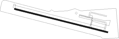
Runway info
| Runway 9 / 27 | ||
| length | 1189m (3901ft) | |
| bearing | 103° / 283° | |
| width | 18m (60ft) | |
| surface | asphalt | |
| blast zone | 30m (98ft) / 0m (0ft) | |
Instrument approach procedures
| runway | airway (heading) | route (dist, bearing) |
|---|---|---|
| RW27 | EXIHO (282°) | EXIHO 6000ft EXIHO (turn) 4300ft |
| RW27 | ISROQ (265°) | ISROQ EXIHO (5mi, 206°) 4300ft |
| RW27 | ULMUW (303°) | ULMUW EXIHO (5mi, 26°) 4300ft |
| RNAV | EXIHO 4300ft OZRAJ (5mi, 282°) 3900ft ZEKAV (3mi, 282°) 2940ft 08D (2mi, 282°) 2280ft (5899mi, 115°) 2620ft EWXUR (5908mi, 295°) 5000ft EWXUR (turn) |
Disclaimer
The information on this website is not for real aviation. Use this data with the X-Plane flight simulator only! Data taken with kind consent from X-Plane 12 source code and data files. Content is subject to change without notice.