Harvard - Harvard State
Airport details
| Country | United States of America |
| State | Nebraska |
| Region | K3 |
| Airspace | Minneapolis Ctr |
| Municipality | Clay County |
| Elevation | 1813ft (553m) |
| Timezone | GMT -6 |
| Coordinates | 40.65133, -98.07989 |
| Magnetic var | |
| Type | land |
| Available since | X-Plane v10.40 |
| ICAO code | 08K |
| IATA code | n/a |
| FAA code | 08K |
Communication
| Harvard State CTAF | 122.900 |
Nearby Points of Interest:
Clay County Courthouse
-Isaac Newton Clark House
-Deering Bridge
-Glenville School
-Fairfield Carnegie Library
-Streeter-Peterson House
-McCormick Hall
-Nowlan-Dietrich House
-Farrell Block
-William Brach House
-Foote Clinic
-Stein Brothers Building
-St. Mark's Pro-Cathedral
-Nebraska Loan and Trust Company Building
-IOOF Opera House
-Nine Bridges Bridge
-Heinrich Giese House
-Shady Bend Gas Station, Grocery, and Diner
-Oscar Roeser House
-Cathedral of the Nativity of the Blessed Virgin Mary (Grand Island, Nebraska)
-Hall County Courthouse
-H. J. Bartenbach House
-Liederkranz
-Grand Island United States Post Office and Courthouse
-Grand Island Carnegie Library
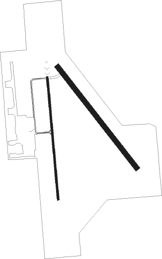
Runway info
Runway 14 / 32  | ||
| length | 1183m (3881ft) | |
| bearing | 139° / 319° | |
| width | 46m (150ft) | |
| surface | grass | |
| Runway 17 / 35 | ||
| length | 1135m (3724ft) | |
| bearing | 179° / 359° | |
| width | 18m (60ft) | |
| surface | asphalt | |
| blast zone | 145m (476ft) / 87m (285ft) | |
Nearby beacons
| code | identifier | dist | bearing | frequency |
|---|---|---|---|---|
| HSI | HASTINGS VOR/DME | 16.1 | 262° | 108.80 |
| GR | SANCY NDB | 17 | 313° | 380 |
| GRI | GRAND ISLAND VOR/DME | 22.6 | 325° | 112 |
| FMZ | BEKLOF (FAIRMONT) NDB | 23.6 | 97° | 392 |
| JYR | YORK NDB | 25.7 | 62° | 257 |
| EAR | KEARNEY VOR | 42.3 | 275° | 111.20 |
| OBH | WOLBACH VORTAC | 45.2 | 339° | 114.80 |
| FBY | FAIRBURY NDB | 50.5 | 117° | 293 |
| TKO | MANKATO VORTAC | 51.4 | 192° | 109.80 |
| OLU | COLUMBUS VOR/DME | 58.4 | 43° | 111.80 |
| PLT | PLATTE CENTER (COLUMBUS) NDB | 59.7 | 40° | 407 |
| ODX | ORD NDB | 70.3 | 318° | 356 |
Instrument approach procedures
| runway | airway (heading) | route (dist, bearing) |
|---|---|---|
| RW17 | BRADY (196°) | BRADY ZIGIS (7mi, 223°) 4100ft |
| RW17 | GRI (145°) | GRI ZIGIS (13mi, 120°) 4100ft |
| RW17 | HSI (82°) | HSI ZIGIS (21mi, 55°) 4100ft ZIGIS (turn) 4100ft |
| RNAV | ZIGIS 4100ft TEYVU (6mi, 179°) 3600ft HINEK (4mi, 179°) 2360ft 08K (2mi, 175°) 1854ft (5773mi, 113°) 2102ft CHALS (5774mi, 292°) 4000ft CHALS (turn) | |
| RW35 | CHALS (0°) | CHALS 4000ft |
| RW35 | HSI (82°) | HSI KUWUC (13mi, 122°) 4000ft CHALS (6mi, 90°) 4000ft |
| RW35 | NUCDI (256°) | NUCDI HULUN (21mi, 224°) 4000ft CHALS (6mi, 270°) 4000ft |
| RW35 | SUEKI (291°) | SUEKI HULUN (17mi, 272°) 4000ft CHALS (6mi, 270°) 4000ft |
| RNAV | CHALS 4000ft PENEW (6mi, 359°) 3300ft 08K (5mi, 1°) 1846ft (5773mi, 113°) 2101ft ZIGIS (5772mi, 293°) 4100ft ZIGIS (turn) |
Disclaimer
The information on this website is not for real aviation. Use this data with the X-Plane flight simulator only! Data taken with kind consent from X-Plane 12 source code and data files. Content is subject to change without notice.