Redwater - Carthage Leake Co.
Airport details
| Country | United States of America |
| State | Mississippi |
| Region | K7 |
| Airspace | Memphis Ctr |
| Municipality | Carthage |
| Elevation | 454ft (138m) |
| Timezone | GMT -6 |
| Coordinates | 32.76159, -89.53039 |
| Magnetic var | |
| Type | land |
| Available since | X-Plane v10.40 |
| ICAO code | 08M |
| IATA code | n/a |
| FAA code | n/a |
Communication
| Carthage Leake Co. CTAF | 122.900 |
Nearby Points of Interest:
Old First Presbyterian Church
-Downtown Philadelphia Historic District
-Old US Post Office
-Newton station
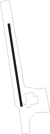
Runway info
| Runway 17 / 35 | ||
| length | 917m (3009ft) | |
| bearing | 175° / 355° | |
| width | 23m (75ft) | |
| surface | asphalt | |
Nearby beacons
| code | identifier | dist | bearing | frequency |
|---|---|---|---|---|
| MHZ | MAGNOLIA (MADISON) VORTAC | 34.8 | 240° | 113.20 |
| JA | ALLEN (JACKSON) NDB | 36.4 | 239° | 365 |
| JH | BRENZ (JACKSON) NDB | 42.5 | 245° | 260 |
| MEI | MERIDIAN VORTAC | 43.3 | 118° | 117 |
| NMM | MERIDIAN TACAN | 51 | 101° | 111.90 |
| SQS | SIDON VORTAC | 56.4 | 313° | 114.70 |
| GW | TEOCK NDB | 57.1 | 326° | 349 |
Disclaimer
The information on this website is not for real aviation. Use this data with the X-Plane flight simulator only! Data taken with kind consent from X-Plane 12 source code and data files. Content is subject to change without notice.