Hendersonville
Airport details
| Country | United States of America |
| State | North Carolina |
| Region | K7 |
| Airspace | Atlanta Ctr |
| Municipality | Henderson County |
| Elevation | 2083ft (635m) |
| Timezone | GMT -5 |
| Coordinates | 35.30762, -82.43317 |
| Magnetic var | |
| Type | land |
| Available since | X-Plane v10.40 |
| ICAO code | 0A7 |
| IATA code | n/a |
| FAA code | 0A7 |
Communication
| Hendersonville CTAF/UNICOM | 123.000 |
Nearby Points of Interest:
Grey Hosiery Mill
-Henderson County Courthouse
-Main Street Historic District
-Reese House
-Seventh Avenue Depot District
-King-Waldrop House
-Clarke-Hobbs-Davidson House
-St. John in the Wilderness
-Carl Sandburg Home National Historic Site
-Flat Rock Historic District
-Charlton Leland
-Church of the Transfiguration
-Ryder Hall
-Rugby Grange
-The Meadows
-Mills River Chapel
-Seven Hearths
-Blake House
-Lynncote
-Bank of Tryon Building
-Sunnydale
-J. G. Hughes House
-Polk County Courthouse
-Blockhouse Site
-John H. Goodwin House
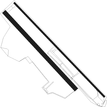
Runway info
Runway 14 / 32  | ||
| length | 741m (2431ft) | |
| bearing | 136° / 316° | |
| width | 30m (100ft) | |
| surface | grass | |
| Runway 15 / 33 | ||
| length | 933m (3061ft) | |
| bearing | 135° / 315° | |
| width | 12m (40ft) | |
| surface | asphalt | |
| displ threshold | 83m (272ft) / 92m (302ft) | |
Nearby beacons
| code | identifier | dist | bearing | frequency |
|---|---|---|---|---|
| BRA | BROAD RIVER (ASHEVILLE) NDB | 2.7 | 227° | 379 |
| SUG | SUGARLOAF MT. (ASHEVILLE) VORTAC | 10 | 59° | 112.20 |
| IM | KEANS (ASHEVILLE) NDB | 15.4 | 326° | 357 |
| SPA | SPARTANBURG VORTAC | 29.8 | 118° | 115.70 |
| GM | JUDKY (GREENVILLE) NDB | 31.9 | 171° | 521 |
| GY | DYANA (GREENVILLE) NDB | 37 | 181° | 338 |
| SLP | FIRST RIVER (SHELBY) NDB | 41 | 94° | 417 |
| SOT | SNOWBIRD VORTAC | 41.8 | 308° | 108.80 |
| FIQ | FIDDLERS (MORGANTON) NDB | 44.4 | 62° | 391 |
| UOT | UNION COUNTY NDB | 54 | 128° | 326 |
| ELW | ELECTRIC CITY (ANDERSON) VORTAC | 56 | 202° | 108.60 |
| ODF | FOOTHILLS (TOCCOA) VOR/DME | 56.1 | 235° | 113.40 |
| BAR | HEMLOCK (BANNER ELK) NDB | 57.5 | 33° | 320 |
| EOE | ENOREE (NEWBERRY) NDB | 71.5 | 141° | 278 |
Disclaimer
The information on this website is not for real aviation. Use this data with the X-Plane flight simulator only! Data taken with kind consent from X-Plane 12 source code and data files. Content is subject to change without notice.