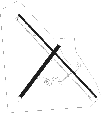
Hartington - Hartington Muni/bud Becker Fld
Airport details
| Country | United States of America |
| State | Nebraska |
| Region | K3 |
| Airspace | Minneapolis Ctr |
| Municipality | Cedar County |
| Elevation | 1388ft (423m) |
| Timezone | GMT -6 |
| Coordinates | 42.60308, -97.25350 |
| Magnetic var | |
| Type | land |
| Available since | X-Plane v10.40 |
| ICAO code | 0B4 |
| IATA code | n/a |
| FAA code | 0B4 |
Communication
| Hartington Muni/Bud Becker Fld CTAF | 122.900 |
| Hartington Muni/Bud Becker Fld MINNEAPOLIS ApproachROACH | 128.000 |
| Hartington Muni/Bud Becker Fld MINNEAPOLIS DepartureARTURE | 128.000 |
Nearby Points of Interest:
Cedar County Courthouse
-Hartington City Hall and Auditorium
-Hartington Hotel
-Saints Philip and James Parochial School
-Argo Hotel
-William Andre House
-Governor John L. Pennington House
-Harold A. (H.A.) Doyle House
-Dr. John Trierweiler House
-Pospeshil Theatre
-Dr. B.M. Banton House
-Chicago, Milwaukee and St. Paul Depot
-Clay County Courthouse
-Yankton College
-St. Agnes Catholic Church
-Linden House
-Van Osdel House
-United Church of Christ
-Human Services Center
-Volin Town Hall
-Dixon County Courthouse
-Ponca Historic District
-Cook Blacksmith Shop
-Wayne United States Post Office
-Utica Fire and City Hall
Nearby beacons
| code | identifier | dist | bearing | frequency |
|---|---|---|---|---|
| YK | CAGUR (YANKTON) NDB | 14.6 | 349° | 347 |
| YKN | YANKTON VOR/DME | 19.8 | 337° | 111.40 |
| OI | TOMMI (SIOUX CITY) NDB | 36 | 100° | 305 |
| OFK | NORFOLK VOR/DME | 37.8 | 196° | 109.60 |
| SUX | SIOUX CITY TACAN | 44 | 106° | 116.50 |
| SU | SALIX (SOUIX CITY) NDB | 45.7 | 106° | 414 |
| FS | ROKKY (SIOUX FALLS) NDB | 56.6 | 25° | 245 |
| SCB | SCRIBNER VOR/DME | 66.1 | 148° | 111 |
Instrument approach procedures
| runway | airway (heading) | route (dist, bearing) |
|---|---|---|
| RW13 | HARDS (77°) | HARDS COVIL (10mi, 3°) 3200ft COVIL (turn) 3200ft |
| RW13 | HIVNO (132°) | HIVNO COVIL (10mi, 132°) 3200ft |
| RW13 | YKN (157°) | YKN COVIL (11mi, 183°) 3200ft |
| RNAV | COVIL 3200ft BATOM (5mi, 132°) 3100ft ZAMEL (3mi, 132°) 2140ft 0B4 (3mi, 134°) 1412ft (5725mi, 114°) 1747ft COTPO (5719mi, 294°) 3200ft COTPO (turn) | |
| RW31 | ATLES (301°) | ATLES COTPO (11mi, 291°) 3200ft |
| RW31 | COTPO (312°) | COTPO 3200ft |
| RW31 | HURLI (270°) | HURLI DUVAS (10mi, 247°) 3200ft COTPO (6mi, 239°) 3200ft |
| RW31 | MAGET (28°) | MAGET BAYNY (12mi, 64°) 3400ft COTPO (5mi, 59°) 3200ft |
| RNAV | COTPO 3200ft ANLIE (5mi, 313°) 3200ft WUNIT (3mi, 313°) 2220ft 0B4 (3mi, 312°) 1427ft (5725mi, 114°) 1690ft COVIL (5731mi, 294°) 3200ft COVIL (turn) |
Disclaimer
The information on this website is not for real aviation. Use this data with the X-Plane flight simulator only! Data taken with kind consent from X-Plane 12 source code and data files. Content is subject to change without notice.

