Seneca Falls - Finger Lakes Regl
Airport details
| Country | United States of America |
| State | New York |
| Region | K6 |
| Airspace | Cleveland Ctr |
| Municipality | Town of Seneca Falls |
| Elevation | 492ft (150m) |
| Timezone | GMT -5 |
| Coordinates | 42.88356, -76.78117 |
| Magnetic var | |
| Type | land |
| Available since | X-Plane v10.40 |
| ICAO code | 0G7 |
| IATA code | n/a |
| FAA code | n/a |
Communication
| Finger Lakes Regl AWOS 3 | 120.000 |
| Finger Lakes Regl CTAF/UNICOM | 122.800 |
| Finger Lakes Regl SYRACUSE Approach Departure | 126.125 |
| Finger Lakes Regl ROCHESTER Approach | 119.550 |
Nearby Points of Interest:
Amelia Bloomer House
-Fourth Ward School
-Julius and Harriet Bull House
-United States Post Office
-Hunt House (Waterloo, New York)
-James Russell Webster House
-William H. Burton House
-Montezuma Marsh
-Wesleyan Methodist Church
-John Graves Cobblestone Farmhouse
-Cobblestone Farmhouse at 1229 Birdsey Road
-Rose Hill Mansion
-Cobblestone Farmhouse at 1111 Stone Church Road
-Cobblestone Farmhouse at 1027 Stone Church Rd.
-Seneca River Crossing Canals Historic District
-Mentz Church
-Aurora Steam Grist Mill
-Aurora Village–Wells College Historic District
-Mosher Farmstead
-Geneva Downtown Commercial Historic District
-Farmers and Merchants Bank
-Nester House
-Smith's Opera House
-South Main Street Historic District
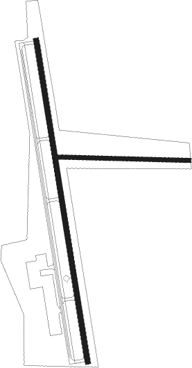
Runway info
Runway 1 / 19  | ||
| length | 1401m (4596ft) | |
| bearing | 354° / 174° | |
| width | 23m (75ft) | |
| surface | asphalt | |
| displ threshold | 122m (400ft) / 0m (0ft) | |
| Runway 11 / 29 | ||
| length | 563m (1847ft) | |
| bearing | 94° / 274° | |
| width | 18m (60ft) | |
| surface | grass | |
Nearby beacons
| code | identifier | dist | bearing | frequency |
|---|---|---|---|---|
| PYA | PENN YAN NDB | 18.8 | 229° | 260 |
| ITH | DME | 27.3 | 140° | 111.80 |
| SYR | SYRACUSE VORTAC | 30.2 | 64° | 117 |
| FZ | FALLN (FULTON) NDB | 32 | 50° | 220 |
| IT | VRNAH (ITHACA) NDB | 32.7 | 138° | 266 |
| ALP | ALPINE (ELMIRA) NDB | 38.7 | 178° | 245 |
| ROC | ROCHESTER VOR/DME | 41.6 | 285° | 110 |
| GEE | GENESEO VOR/DME | 41.9 | 267° | 108.20 |
| GGT | GEORGETOWN TACAN | 42.4 | 96° | 117.80 |
| ULW | ELMIRA VOR/DME | 48.6 | 197° | 109.65 |
| CFB | BINGHAMTON VOR/DME | 52.1 | 138° | 112.20 |
Instrument approach procedures
| runway | airway (heading) | route (dist, bearing) |
|---|---|---|
| RW01 | EBIHY (26°) | EBIHY HADCI (6mi, 87°) 3900ft |
| RW01 | FEHLO (324°) | FEHLO HADCI (6mi, 267°) 3900ft |
| RW01 | HADCI (354°) | HADCI 3900ft |
| RNAV | HADCI 3900ft CEBUV (8mi, 354°) 2200ft ZETEM (3mi, 354°) 1120ft 0G7 (2mi, 355°) 532ft (4826mi, 119°) 1000ft HADCI (4823mi, 299°) 3900ft HADCI (turn) | |
| RW19 | HUDEN (205°) | HUDEN JLIET (6mi, 267°) 2400ft |
| RW19 | JLIET (173°) | JLIET 2400ft |
| RW19 | ZORAB (143°) | ZORAB JLIET (6mi, 87°) 2400ft |
| RNAV | JLIET 2400ft CEPEB (8mi, 174°) 2200ft 0G7 (6mi, 173°) 522ft (4826mi, 119°) 1200ft JLIET (4829mi, 299°) 2400ft JLIET (turn) |
Disclaimer
The information on this website is not for real aviation. Use this data with the X-Plane flight simulator only! Data taken with kind consent from X-Plane 12 source code and data files. Content is subject to change without notice.