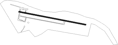
Cynthiana - Cynthiana Harrison County
Airport details
| Country | United States of America |
| State | Kentucky |
| Region | K5 |
| Airspace | Indianapolis Ctr |
| Municipality | Harrison County |
| Elevation | 722ft (220m) |
| Timezone | GMT -5 |
| Coordinates | 38.36617, -84.28335 |
| Magnetic var | |
| Type | land |
| Available since | X-Plane v10.40 |
| ICAO code | 0I8 |
| IATA code | n/a |
| FAA code | n/a |
Communication
| Cynthiana Harrison County CTAF/UNICOM | 122.800 |
Nearby Points of Interest:
Spur Gasoline Station
-Church of the Advent, Episcopal
-Cynthiana Commercial District
-The Grange
-Paris Courthouse Square Historic District
-Stone Barn on Brushy Creek
-Forest Retreat
-William Mathers House
-Thomas Metcalf House
-Erasmus Riggs House
-Thomas A. Dorsey Farmhouse
-Robertson County Courthouse
-Georgetown East Main Street Residential District
-Shropshire House
-Cardome Centre
-Johnston-Jacobs House
-Giddings Hall, Georgetown College
-Georgetown College Historic Buildings
-First African Baptist Church and Parsonage
-Hawkins House
-Scott County Jail Complex
-Payne-Desha House
-Branham House
-Holy Trinity Episcopal Church
-Garth School
Nearby beacons
| code | identifier | dist | bearing | frequency |
|---|---|---|---|---|
| FLM | FALMOUTH VOR/DME | 17 | 355° | 117 |
| GN | BRIDL (LEXINGTON) NDB | 17.9 | 223° | 340 |
| IOB | MOUNT STERLING NDB | 23.2 | 135° | 210 |
| HYK | LEXINGTON VOR/DME | 25.6 | 205° | 112.60 |
| LE | BLAYD (LEXINGTON) NDB | 28.9 | 225° | 242 |
| FFT | FRANKFORT VOR | 31.4 | 254° | 109.40 |
| PWF | SPORTYS (BATAVIA) NDB | 42.7 | 5° | 245 |
| CVG | CINCINNATI VORTAC | 43.7 | 327° | 117.30 |
| DVK | GOODALL (DANVILLE) NDB | 52.6 | 211° | 311 |
| HW | CUBLA (WILMINGTON) NDB | 62.2 | 22° | 299 |
| HLB | BATESVILLE NDB | 74.4 | 315° | 254 |
Instrument approach procedures
| runway | airway (heading) | route (dist, bearing) |
|---|---|---|
| RW11 | ZIXEN (102°) | ZIXEN 3000ft |
| RNAV | ZIXEN 3000ft HUCIX (6mi, 102°) 2500ft UZXAM (3mi, 102°) 1460ft 0I8 (3mi, 102°) 761ft (5136mi, 114°) 1121ft DATAC (5125mi, 295°) 3000ft DATAC (turn) | |
| RW29 | DATAC (282°) | DATAC 3000ft |
| RNAV | DATAC 3000ft ZUTOM (6mi, 282°) 2500ft WAKVU (3mi, 282°) 1440ft 0I8 (2mi, 282°) 758ft (5136mi, 114°) 1121ft ZIXEN (5147mi, 294°) 3000ft ZIXEN (turn) |
Disclaimer
The information on this website is not for real aviation. Use this data with the X-Plane flight simulator only! Data taken with kind consent from X-Plane 12 source code and data files. Content is subject to change without notice.
