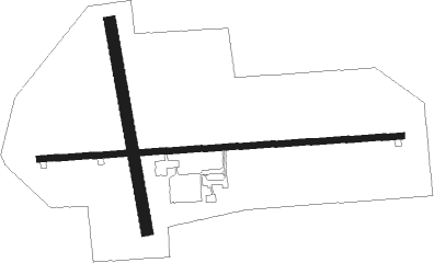
Headland - Headland Muni
Airport details
| Country | United States of America |
| State | Alabama |
| Region | K7 |
| Airspace | Jacksonville Ctr |
| Municipality | Headland |
| Elevation | 357ft (109m) |
| Timezone | GMT -6 |
| Coordinates | 31.36414, -85.31253 |
| Magnetic var | |
| Type | land |
| Available since | X-Plane v10.40 |
| ICAO code | 0J6 |
| IATA code | n/a |
| FAA code | n/a |
Communication
| HEADLAND MUNI CTAF | 122.900 |
| HEADLAND MUNI CAIRNS Approach/Departure | 125.400 |
Nearby Points of Interest:
Federal Building and United States Courthouse
-Purcell-Killingsworth House
-Kennedy House
-Early County Courthouse
-Blakely Court Square Historic District
-Dill House
-Seaboard Coastline Depot
-Seminole County Courthouse
-Erwin House
-Pender's Store
-Great Oaks
-Henry D. Clayton House
-Miller-Martin Town House
-Grace Episcopal Church
-Petty-Roberts-Beatty House
-Fendall Hall
-Kiels-McNab House
-Cato House
-Kendall Manor
-The Tavern
-Sheppard Cottage
-McNab Bank Building
-Wellborn
-Quitman County Courthouse and Old Jail
-Shorter Mansion

Nearby beacons
| code | identifier | dist | bearing | frequency |
|---|---|---|---|---|
| RRS | WIREGRASS (DOTHAN) VORTAC | 7.7 | 236° | 111.60 |
| HEY | HANCHEY (FT RUCKER) VOR | 17.4 | 272° | 110.60 |
| HYE | HANCHEY (FT RUCKER) NDB | 17.5 | 272° | 221 |
| OZR | CAIRNS (FT RUCKER) VOR/DME | 21.9 | 257° | 111.20 |
| LOR | LOWE (FORT RUCKER) NDB | 22.1 | 270° | 269 |
| OZ | RUCKR (FT RUCKER) NDB | 27.1 | 255° | 212 |
| SMY | SOYYA (MARIANNA) NDB | 29.9 | 170° | 329 |
| EDN | ENTERPRISE VOR | 30.5 | 263° | 116.60 |
| BVG | BOLL WEEVIL (ENTERPRISE) NDB | 34.3 | 268° | 352 |
| MAI | MARIANNA VORTAC | 36 | 162° | 114 |
| EUF | EUFAULA VORTAC | 36.4 | 17° | 109.20 |
| LYZ | WILLIS (BAINBRIDGE) NDB | 46.8 | 116° | 359 |
| TOI | BLOOD (TROY) NDB | 49.3 | 300° | 365 |
| AWS | LAWSON (COLUMBUS) NDB | 57.6 | 17° | 335 |
| LSF | LAWSON (COLUMBUS) VOR/DME | 60.3 | 18° | 111.40 |
| SZW | SEMINOLE VORTAC | 68.4 | 131° | 117.50 |
Instrument approach procedures
| runway | airway (heading) | route (dist, bearing) |
|---|---|---|
| RW09 | DEKKE (91°) | DEKKE 2000ft |
| RNAV | DEKKE 2000ft ERUCA (6mi, 91°) 1700ft EMVUF (2mi, 91°) 980ft 0J6 (2mi, 90°) 394ft (5165mi, 110°) 628ft WAGKY (5154mi, 290°) 2000ft WAGKY (turn) | |
| RW27 | WAGKY (271°) | WAGKY 2000ft |
| RNAV | WAGKY 2000ft YUCUL (6mi, 271°) 1700ft CUNLU (2mi, 271°) 1000ft 0J6 (2mi, 271°) 395ft (5165mi, 110°) 900ft WAGKY (5154mi, 290°) 2000ft WAGKY (turn) |
Disclaimer
The information on this website is not for real aviation. Use this data with the X-Plane flight simulator only! Data taken with kind consent from X-Plane 12 source code and data files. Content is subject to change without notice.