Sandy Valley - Jean
Airport details
| Country | United States of America |
| State | Nevada |
| Region | K2 |
| Airspace | Los Angeles Ctr |
| Municipality | Clark County |
| Elevation | 2832ft (863m) |
| Timezone | GMT -8 |
| Coordinates | 35.76827, -115.32964 |
| Magnetic var | |
| Type | land |
| Available since | X-Plane v10.40 |
| ICAO code | 0L7 |
| IATA code | n/a |
| FAA code | n/a |
Communication
| Jean KHND AWOS | 120.775 |
| Jean CTAF | 122.900 |
| Jean Los Angeles Nelson | 134.650 |
Nearby Points of Interest:
Goodsprings Schoolhouse
-Sandstone Ranch
-Las Vegas Springs
-Huntridge Theatre
-Jay Dayton Smith House
-Railroad Cottage Historic District
-Las Vegas High School Neighborhood Historic District
-Las Vegas Grammar School
-Las Vegas High School Academic Building and Gymnasium
-Morelli House
-The Green Shack
-Clark Avenue Railroad Underpass
-Harrison's Guest House
-Old Las Vegas Mormon Fort State Historic Park
-Boulder City Historic District
-Boulder City Hospital
-Kyle Ranch
-Eureka
-Willow Beach Gauging Station
Runway info
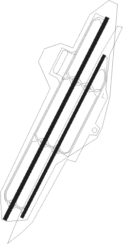
Runway 2L / 20R  | ||
| length | 1406m (4613ft) | |
| bearing | 37° / 217° | |
| width | 23m (75ft) | |
| surface | asphalt | |
| blast zone | 0m (0ft) / 90m (295ft) | |
| Runway 2R / 20L | ||
| length | 1130m (3707ft) | |
| bearing | 37° / 217° | |
| width | 18m (60ft) | |
| surface | asphalt | |
Nearby beacons
| code | identifier | dist | bearing | frequency |
|---|---|---|---|---|
| GOG | DME | 11 | 307° | 112.05 |
| LAS | LAS VEGAS VORTAC | 20.4 | 29° | 116.90 |
| BLD | BOULDER CITY VORTAC | 26.4 | 64° | 116.70 |
| LSV | NELLIS (LAS VEGAS) TACAN | 32.2 | 33° | 135.50 |
| GFS | GOFFS VORTAC | 38.9 | 166° | 114.40 |
| INS | INDIAN SPRINGS TACAN | 51.7 | 337° | 114 |
Disclaimer
The information on this website is not for real aviation. Use this data with the X-Plane flight simulator only! Data taken with kind consent from X-Plane 12 source code and data files. Content is subject to change without notice.