Hohenwald - John A Baker Field
Airport details
| Country | United States of America |
| State | Tennessee |
| Region | K7 |
| Airspace | Memphis Ctr |
| Municipality | Hohenwald |
| Elevation | 972ft (296m) |
| Timezone | GMT -6 |
| Coordinates | 35.54597, -87.59734 |
| Magnetic var | |
| Type | land |
| Available since | X-Plane v10.40 |
| ICAO code | 0M3 |
| IATA code | n/a |
| FAA code | n/a |
Communication
| John A Baker Field CTAF/UNICOM | 122.800 |
Nearby Points of Interest:
Lewis County Courthouse
-Hufstedler Gravehouse
-Perry County Courthouse
-Webster Farm
-Garrett House
-Skipwith Hall
-Pine Hill
-Clifton Place
-John P. Rains Hotel
-Columbia Arsenal
-Mercer Hall
-Athenaeum
-Union Station
-Polk Sisters' House
-Elisha White House
-Milky Way Farm
-Olivet United Methodist Church, Parsonage and School
-George W. Tillery House
Runway info
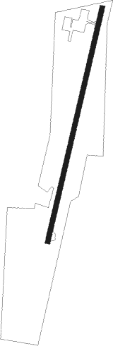
| Runway 2 / 20 | ||
| length | 1221m (4006ft) | |
| bearing | 21° / 201° | |
| width | 23m (75ft) | |
| surface | asphalt | |
| displ threshold | 0m (0ft) / 152m (499ft) | |
Nearby beacons
| code | identifier | dist | bearing | frequency |
|---|---|---|---|---|
| GHM | (CENTERVILLE) DME | 18.6 | 27° | 111.60 |
| MSL | MUSCLE SHOALS VORTAC | 50.6 | 173° | 116.50 |
| BNA | NASHVILLE VORTAC | 56.8 | 57° | 114.10 |
| CK | SNUFF(FT CAMPBELL (CLARKSVILLE NDB | 59.8 | 12° | 335 |
| DCU | DME | 62.8 | 144° | 112.80 |
| RQZ | ROCKET (HUNTSVILLE) VORTAC | 65.2 | 128° | 112.20 |
Instrument approach procedures
| runway | airway (heading) | route (dist, bearing) |
|---|---|---|
| RW02 | QUGEG (21°) | QUGEG 3000ft |
| RNAV | QUGEG 3000ft UZLAT (7mi, 21°) 2600ft 0M3 (5mi, 21°) 989ft (5288mi, 112°) 2000ft QUGEG (5291mi, 292°) 3000ft QUGEG (turn) |
Disclaimer
The information on this website is not for real aviation. Use this data with the X-Plane flight simulator only! Data taken with kind consent from X-Plane 12 source code and data files. Content is subject to change without notice.