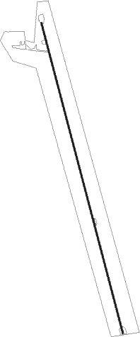
Geary - Mckinley Ranch
Airport details
| Country | United States of America |
| State | Oklahoma |
| Region | K4 |
| Airspace | Ft Worth Ctr |
| Municipality | Blaine County |
| Elevation | 1419ft (433m) |
| Timezone | GMT -6 |
| Coordinates | 35.61950, -98.52257 |
| Magnetic var | |
| Type | land |
| Available since | X-Plane v10.40 |
| ICAO code | 0OK3 |
| IATA code | n/a |
| FAA code | 0OK3 |
Communication
Nearby Points of Interest:
Provine Service Station
-Rock Mary
-Blaine County Courthouse
-Fort Reno
-Darlington Agency
-Mennoville Mennonite Church
-El Reno Municipal Swimming Pool Bath House
-Rock Island Depot
-Canadian County Jail and Stable
-William I. and Magdalen M. Goff House
-Avant's Cities Service Station
-El Reno High School
-Carnegie Library
-Henry Lassen House
-Cordell Carnegie Public Library
-Washita County Courthouse
-Governor Seay Mansion
-Kingfisher Post Office
Runway info
| Runway 16 / 34 | ||
| length | 1513m (4964ft) | |
| bearing | 167° / 347° | |
| width | 9m (30ft) | |
| surface | asphalt | |
Nearby beacons
| code | identifier | dist | bearing | frequency |
|---|---|---|---|---|
| IFI | KINGFISHER VORTAC | 27.6 | 70° | 114.70 |
| BZ | FOSSI (CLINTON) NDB | 34.6 | 256° | 393 |
| BFV | BURNS FLAT (CLINTON) VORTAC | 40.5 | 241° | 110 |
| PWA | WILEY POST (OKLAHOMA CITY VOR/DME | 43 | 96° | 113.40 |
| IRW | WILL ROGERS (OKLAHOMA CIT VORTAC | 47.3 | 106° | 114.10 |
| RG | GALLY (OKLAHOMA CITY) NDB | 49.6 | 109° | 350 |
| HBR | HOBART VORTAC | 52.4 | 216° | 111.80 |
| END | VANCE (ENID) VORTAC | 52.5 | 40° | 115.40 |
| EI | GARFY (ENID) NDB | 53 | 48° | 341 |
| ODG | WOODRING (ENID) VOR/DME | 57.6 | 44° | 109 |
| LTS | ALTUS VORTAC | 68.2 | 218° | 109.80 |
Disclaimer
The information on this website is not for real aviation. Use this data with the X-Plane flight simulator only! Data taken with kind consent from X-Plane 12 source code and data files. Content is subject to change without notice.
