Columbia - Columbia-marion County
Airport details
| Country | United States of America |
| State | Mississippi |
| Region | K7 |
| Airspace | Houston Oceanic Ctr |
| Municipality | Marion County |
| Elevation | 265ft (81m) |
| Timezone | GMT -6 |
| Coordinates | 31.29700, -89.81284 |
| Magnetic var | |
| Type | land |
| Available since | X-Plane v10.40 |
| ICAO code | 0R0 |
| IATA code | n/a |
| FAA code | n/a |
Communication
| Columbia-Marion County CTAF/UNICOM | 122.800 |
Nearby Points of Interest:
John Ford Home
-Jefferson Davis County Courthouse
-Lawrence County Courthouse
-Longleaf Trace
-Covington County Courthouse
-Walthall School
-Beverly Drive-In Theater
-Eaton Elementary School
-Bogalusa City Hall
-Bogalusa Post Office
-Robert "Bob" Hicks House
-Greenlaw House
-Thomas M. Babington House
-William Frederick Holmes House
-Magnolia Depot
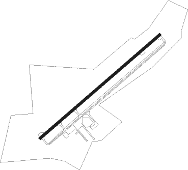
Runway info
| Runway 5 / 23 | ||
| length | 1360m (4462ft) | |
| bearing | 58° / 238° | |
| width | 21m (70ft) | |
| surface | asphalt | |
Nearby beacons
| code | identifier | dist | bearing | frequency |
|---|---|---|---|---|
| MCB | MC COMB VORTAC | 22.8 | 271° | 116.70 |
| GVB | BOGALUSA NDB | 25 | 187° | 353 |
| LBY | EATON (HATTIESBURG) VORTAC | 25.4 | 76° | 110.60 |
| MC | FERNI (MCCOMB) NDB | 35.8 | 267° | 413 |
| PCU | PICAYUNE VOR/DME | 44.3 | 174° | 113.95 |
| HP | ANGER (HAMMOND) NDB | 51.9 | 221° | 212 |
| HS | HANCO (BAY ST LOUIS) NDB | 54 | 157° | 221 |
| GP | BAYOU NDB | 59.1 | 141° | 360 |
| GPT | GULFPORT VORTAC | 65.5 | 140° | 109 |
| BIX | KEESLER (BILOXI) TACAN | 70.2 | 135° | 111.80 |
Instrument approach procedures
| runway | airway (heading) | route (dist, bearing) |
|---|---|---|
| RW05 | HULNA (58°) | HULNA 2400ft |
| RNAV | HULNA 2400ft ZOSOG (6mi, 58°) 1500ft CECAK (2mi, 58°) 920ft 0R0 (2mi, 58°) 284ft (5396mi, 109°) 494ft NERAE (5387mi, 289°) 2400ft NERAE (turn) | |
| RW23 | NERAE (238°) | NERAE 2400ft |
| RNAV | NERAE 2400ft NATVE (5mi, 238°) 1900ft 0R0 (6mi, 238°) 315ft (5396mi, 109°) 588ft HULNA (5404mi, 289°) 2400ft HULNA (turn) |
Disclaimer
The information on this website is not for real aviation. Use this data with the X-Plane flight simulator only! Data taken with kind consent from X-Plane 12 source code and data files. Content is subject to change without notice.