Atmore - Atmore Muni
Airport details
| Country | United States of America |
| State | Alabama |
| Region | K7 |
| Airspace | Jacksonville Ctr |
| Municipality | Atmore |
| Elevation | 287ft (87m) |
| Timezone | GMT -6 |
| Coordinates | 31.01622, -87.44675 |
| Magnetic var | |
| Type | land |
| Available since | X-Plane v10.32 |
| ICAO code | 0R1 |
| IATA code | n/a |
| FAA code | n/a |
Communication
| Atmore Muni CTAF/UNICOM | 122.800 |
Nearby Points of Interest:
Alger-Sullivan Lumber Company Residential Historic District
-First Baptist Church
-Nelson House
-Stockton Methodist Church
-Old Mobile Site
-St. Patrick's Catholic Church
-Gainestown Schoolhouse
-Wilson-Finlay House
-Isaac Nettles Gravestones
-Ellicott's Stone
-Mobile-Tensaw River Delta
-Mount Vernon Arsenal
-Arcadia Sawmill and Arcadia Cotton Mill
-Dellet Plantation
-Milton Historic District
-Mt. Pilgrim African Baptist Church
-Ollinger-Cobb House
-Louisville and Nashville Depot
-Andrews Chapel
-Asa Johnston Farmhouse
-Methodist Episcopal Church, South (Daphne, Alabama)
Runway info
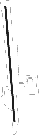
| Runway 18 / 36 | ||
| length | 1526m (5007ft) | |
| bearing | 180° / 0° | |
| width | 24m (80ft) | |
| surface | asphalt | |
Nearby beacons
| code | identifier | dist | bearing | frequency |
|---|---|---|---|---|
| MVC | MONROEVILLE VORTAC | 27 | 12° | 116.80 |
| NSE | WHITING (MILTON) TACAN | 28.2 | 124° | 112.30 |
| NUN | SAUFLEY (PENSACOLA) VOR | 33.1 | 168° | 108.80 |
| NGS | SANTA ROSA (MILTON) TACAN | 35.6 | 128° | 133.60 |
| PKZ | PICKENS (PENSACOLA) NDB | 37.4 | 155° | 326 |
| BFM | BROOKLEY (MOBILE) VORTAC | 39.6 | 236° | 112.80 |
| NPA | PENSACOLA TACAN | 40.1 | 169° | 117.20 |
| CEW | CRESTVIEW VORTAC | 41.1 | 104° | 115.90 |
| MOB | WISLE (MOBILE) NDB | 46.7 | 253° | 248 |
| CE | KOBRA (CRESTVIEW) NDB | 47.9 | 100° | 201 |
| SJI | SEMMES (MOBILE) VORTAC | 50.1 | 252° | 115.30 |
| HRT | HURLBURT (MARY ESTHER) TACAN | 52.6 | 128° | 110.80 |
| DWG | WARRINGTON (VALPARAISO) TACAN | 57.6 | 120° | 134.50 |
Instrument approach procedures
| runway | airway (heading) | route (dist, bearing) |
|---|---|---|
| RW18 | FEVIB (180°) | FEVIB 2600ft |
| RNAV | FEVIB 2600ft HELUD (7mi, 180°) 2000ft JEDAM (3mi, 180°) 1160ft 0R1 (3mi, 180°) 335ft (5274mi, 110°) 613ft GOKDE (5273mi, 289°) 2600ft GOKDE (turn) | |
| RW36 | GOKDE (360°) | GOKDE 2600ft |
| RNAV | GOKDE 2600ft HEVBU (6mi, 360°) 2000ft OKVOE (3mi, 360°) 1100ft 0R1 (3mi, 360°) 320ft (5274mi, 110°) 613ft FEVIB (5274mi, 290°) 2600ft FEVIB (turn) |
Disclaimer
The information on this website is not for real aviation. Use this data with the X-Plane flight simulator only! Data taken with kind consent from X-Plane 12 source code and data files. Content is subject to change without notice.