Nez Perce - Nez Perce Muni
Airport details
| Country | United States of America |
| State | Idaho |
| Region | |
| Airspace | Seattle Ctr |
| Municipality | Lewis County |
| Elevation | 3202ft (976m) |
| Timezone | GMT -8 |
| Coordinates | 46.24191, -116.23953 |
| Magnetic var | |
| Type | land |
| Available since | X-Plane v10.40 |
| ICAO code | 0S5 |
| IATA code | n/a |
| FAA code | 0S5 |
Communication
| Nez Perce Muni CTAF | 122.900 |
Nearby Points of Interest:
James F. Bridwell House
-First Presbyterian Church
-Orofino Historic District
-U.S. Post Office – Orofino Main
-Weippe Prairie
-Brown's Creek CCC Camp Barracks
-American Women's League Chapter House
-Tolo Lake
-Pierce Courthouse
-First Presbyterian Church (Lapwai, Idaho)
-21 Ranchhouse
-Nez Perce National Historical Park
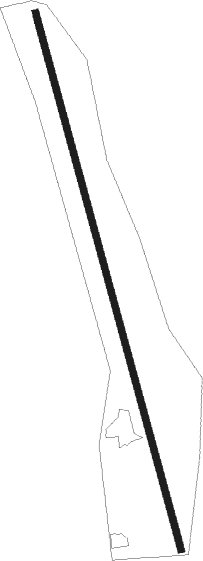
Runway info
| Runway 15 / 33 | ||
| length | 762m (2500ft) | |
| bearing | 165° / 345° | |
| width | 9m (30ft) | |
| surface | asphalt | |
Nearby beacons
| code | identifier | dist | bearing | frequency |
|---|---|---|---|---|
| IDQ | DME | 14.1 | 232° | 115.65 |
| MQG | NEZ PERCE (LEWISTON) VOR/DME | 27.4 | 282° | 108.20 |
| PUW | PULLMAN (PULLMAN/MOSCOW) VOR/DME | 48.2 | 294° | 109 |
Disclaimer
The information on this website is not for real aviation. Use this data with the X-Plane flight simulator only! Data taken with kind consent from X-Plane 12 source code and data files. Content is subject to change without notice.