Minden - Pioneer Village Field
Airport details
| Country | United States of America |
| State | Nebraska |
| Region | K3 |
| Airspace | Minneapolis Ctr |
| Municipality | Minden |
| Elevation | 2160ft (658m) |
| Timezone | GMT -6 |
| Coordinates | 40.51492, -98.94564 |
| Magnetic var | |
| Type | land |
| Available since | X-Plane v10.40 |
| ICAO code | 0V3 |
| IATA code | n/a |
| FAA code | 0V3 |
Communication
| Pioneer Village Field CTAF/UNICOM | 122.700 |
Nearby Points of Interest:
W. T. Thorne Building
-Kearney County Courthouse
-Fort Kearny
-Dobytown
-John J. and Lenora Bartlett House
-Fort Theatre
-Hanson-Downing House
-Klehm House
-Dr. A.O. Thomas House
-Saint Luke's Protestant Episcopal Church
-George W. Frank House
-Meisner Bank Building
-George Meisner House
-IOOF Hall and Opera House
-Kinner House
-Gloe Brothers Service Station
-Nebraska Loan and Trust Company Building
-St. Mark's Pro-Cathedral
-William Brach House
-Foote Clinic
-Stein Brothers Building
-Farrell Block
-Nowlan-Dietrich House
-McCormick Hall
-First Congregational Church, U.C.C.
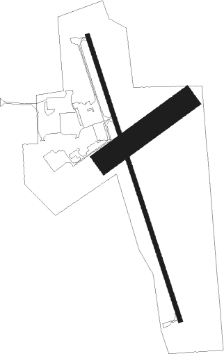
Runway info
Runway 16 / 34  | ||
| length | 1190m (3904ft) | |
| bearing | 162° / 342° | |
| width | 18m (60ft) | |
| surface | concrete | |
| Runway 05 / 23 | ||
| length | 389m (1276ft) | |
| bearing | 65° / 245° | |
| width | 91m (300ft) | |
| surface | grass | |
Nearby beacons
| code | identifier | dist | bearing | frequency |
|---|---|---|---|---|
| EAR | KEARNEY VOR | 12.9 | 344° | 111.20 |
| HSI | HASTINGS VOR/DME | 24.1 | 80° | 108.80 |
| GR | SANCY NDB | 35.8 | 60° | 380 |
| GRI | GRAND ISLAND VOR/DME | 40.2 | 53° | 112 |
| TKO | MANKATO VORTAC | 52.9 | 136° | 109.80 |
| OBH | WOLBACH VORTAC | 58.2 | 35° | 114.80 |
| NRN | NORTON NDB | 58.7 | 235° | 230 |
| CUZ | CUSTER CO. (BROKEN BOW) VOR/DME | 67.2 | 323° | 108.20 |
Instrument approach procedures
| runway | airway (heading) | route (dist, bearing) |
|---|---|---|
| RW16 | CIBSA (162°) | CIBSA 4300ft |
| RW16 | MORGS (231°) | MORGS HENBA (7mi, 282°) 4300ft CIBSA (5mi, 260°) 4300ft |
| RW16 | SPRIT (85°) | SPRIT SUFBA (23mi, 65°) 4300ft CIBSA (5mi, 80°) 4300ft |
| RNAV | CIBSA 4300ft FINVO (6mi, 162°) 3500ft 0V3 (4mi, 162°) 2196ft MEDOC (11mi, 163°) 3700ft MEDOC (turn) | |
| RW34 | HSI (260°) | HSI SMOLA (22mi, 235°) 3700ft MEDOC (5mi, 260°) 3700ft |
| RW34 | MEDOC (343°) | MEDOC 3700ft |
| RW34 | SPRIT (85°) | SPRIT ONLEY (26mi, 105°) 4500ft MEDOC (5mi, 80°) 3700ft |
| RNAV | MEDOC 3700ft LUDMA (6mi, 343°) 3700ft 0V3 (5mi, 343°) 2193ft CIBSA (10mi, 342°) 4300ft CIBSA (turn) |
Disclaimer
The information on this website is not for real aviation. Use this data with the X-Plane flight simulator only! Data taken with kind consent from X-Plane 12 source code and data files. Content is subject to change without notice.