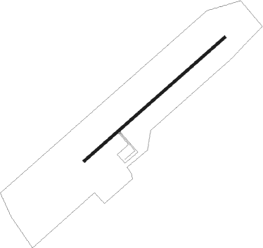
Brookneal - Brookneal Campbell County
Airport details
| Country | United States of America |
| State | Virginia |
| Region | K6 |
| Airspace | Washington Ctr |
| Municipality | Campbell County |
| Elevation | 596ft (182m) |
| Timezone | GMT -5 |
| Coordinates | 37.14172, -79.01639 |
| Magnetic var | |
| Type | land |
| Available since | X-Plane v10.40 |
| ICAO code | 0V4 |
| IATA code | n/a |
| FAA code | 0V4 |
Communication
| Brookneal Campbell County AWOS-3 | 120.575 |
| Brookneal Campbell County CTAF/UNICOM | 122.700 |
| Brookneal Campbell County ROANOKE Approach/Departure | 125.475 |
| Brookneal Campbell County ROANOKE Approach/Departure | 135.000 |
Nearby Points of Interest:
Shady Grove (Gladys, Virginia)
-Green Hill (Long Island, Virginia)
-Blenheim
-Collins Ferry Historic District
-Brookneal Historic District
-Cat Rock Sluice of the Roanoke Navigation
-DeJarnette's Tavern
-Red Hill Patrick Henry National Memorial
-Campbell County Courthouse
-Altavista Downtown Historic District
-Dr. Richard Thornton House
-Westview (Brookneal, Virginia)
-Oak Grove (Altavista, Virginia)
-Staunton Hill
-Mansion Truss Bridge
-Locust Hill (Hurt, Virginia)
-Hill Grove School
-Avoca (Altavista, Virginia)
-Walnut Hill (Lynchburg, Virginia)
-Caryswood
-Gravel Hill
-Montview
-Norfolk Southern Six Mile Bridge No. 58
-Appomattox Historic District
-Appomattox Station
Nearby beacons
| code | identifier | dist | bearing | frequency |
|---|---|---|---|---|
| LYH | LYNCHBURG VOR/DME | 12.5 | 297° | 109.20 |
| LY | BOJAR (LYNCHBURG) NDB | 13 | 298° | 385 |
| SBV | SOUTH BOSTON VORTAC | 28 | 180° | 110.40 |
| DAN | DANVILLE VOR | 37.6 | 209° | 113.10 |
| VIT | VINTON (ROANOKE) NDB | 41.5 | 274° | 277 |
| MOL | MONTEBELLO VOR/DME | 45.7 | 353° | 115.30 |
| BKT | BLACKSTONE NDB | 46.5 | 91° | 326 |
| ODR | WOODRUM (ROANOKE) VOR | 47.3 | 281° | 114.90 |
| HXO | HUNTSBORO (OXFORD) NDB | 53.9 | 155° | 271 |
| UV | BALES (MARTINSVILLE) NDB | 54.5 | 239° | 396 |
| HUR | PERSON (ROXBORO) NDB | 54.6 | 183° | 220 |
| SIF | SLAMMER (REIDSVILLE) NDB | 58 | 224° | 423 |
| GVE | GORDONSVILLE VORTAC | 66.5 | 45° | 115.60 |
Instrument approach procedures
| runway | airway (heading) | route (dist, bearing) |
|---|---|---|
| RW06 | HURTT (82°) | HURTT MEFIH (8mi, 118°) 3000ft |
| RW06 | SYCAM (64°) | SYCAM MEFIH (3mi, 80°) 3000ft MEFIH (turn) 3000ft |
| RNAV | MEFIH 3000ft YEVUV (5mi, 59°) 2400ft OJFOB (3mi, 59°) 1580ft 0V4 (3mi, 59°) 641ft (4881mi, 115°) 1100ft WUGAD (4877mi, 295°) 3000ft WUGAD (turn) | |
| RW24 | LYH (117°) | LYH IRAXE (8mi, 77°) 3200ft WUGAD (7mi, 99°) 3000ft |
| RW24 | WUGAD (213°) | WUGAD 6000ft WUGAD (turn) 3000ft |
| RNAV | WUGAD 3000ft MEHHO (4mi, 191°) 2200ft OVMUY (2mi, 225°) 1580ft SOZIY (3mi, 225°) 791ft (4880mi, 115°) 1000ft WUGAD (4877mi, 295°) 3000ft WUGAD (turn) |
Disclaimer
The information on this website is not for real aviation. Use this data with the X-Plane flight simulator only! Data taken with kind consent from X-Plane 12 source code and data files. Content is subject to change without notice.
