Jonesville - Lee Co
Airport details
| Country | United States of America |
| State | Virginia |
| Region | K6 |
| Airspace | Atlanta Ctr |
| Municipality | Lee County |
| Elevation | 1411ft (430m) |
| Timezone | GMT -5 |
| Coordinates | 36.65408, -83.21783 |
| Magnetic var | |
| Type | land |
| Available since | X-Plane v10.40 |
| ICAO code | 0VG |
| IATA code | n/a |
| FAA code | n/a |
Communication
| Lee Co CTAF | 122.900 |
Nearby Points of Interest:
Jonesville Methodist Campground
-Vardy Community School
-Dickinson-Milbourn House
-Harlan Commercial District
-Hensley Settlement
-Price Public Elementary School
-St. Marks Presbyterian Church
-Rogersville Historic District
-Amis House
-Long Meadow
-Keokee Store No. 1
-John Shell Cabin
-Claiborne County Jail
-Graham-Kivett House
-Fudge Farm
-Stony Point
-Cumberland Central Business District
-Benham Historic District
-Lynch Historic District
-Pineville Courthouse Square Historic District
-William Cocke House
-Middlesboro Downtown Commercial District
-American Association, Limited, Office Building
-Terrace Park Girl Scout Cabin
-John Fox, Jr. House
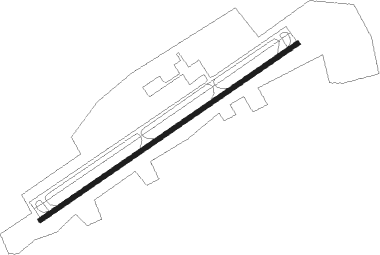
Runway info
| Runway 7 / 25 | ||
| length | 1526m (5007ft) | |
| bearing | 65° / 245° | |
| width | 23m (75ft) | |
| surface | asphalt | |
Nearby beacons
| code | identifier | dist | bearing | frequency |
|---|---|---|---|---|
| RVN | ROGERSVILLE NDB | 20 | 121° | 329 |
| JXT | JEFFERSON (MORRISTOWN) NDB | 34.9 | 205° | 346 |
| BO | BOOIE (BRISTOL) NDB | 38 | 109° | 221 |
| TR | MOCCA(BRISTOL-JOHNSON-KINGSPOR NDB | 43.7 | 96° | 299 |
| AZQ | DME | 44.3 | 356° | 111.20 |
| LOZ | LONDON VOR/DME | 48.5 | 293° | 116.55 |
| SOT | SNOWBIRD VORTAC | 52.5 | 169° | 108.80 |
| VXV | VOLUNTEER (KNOXVILLE) VORTAC | 55.6 | 222° | 116.40 |
Instrument approach procedures
| runway | airway (heading) | route (dist, bearing) |
|---|---|---|
| RW07 | TILYU (65°) | TILYU 5700ft |
| RW07 | WIRVU (30°) | WIRVU TILYU (10mi, 324°) 5700ft |
| RW07 | ZOKAP (94°) | ZOKAP TILYU (10mi, 144°) 5700ft |
| RNAV | TILYU 5700ft SACGO (8mi, 65°) 3400ft HONEB (3mi, 65°) 2360ft 0VG (3mi, 65°) 1406ft (5079mi, 114°) 1643ft OKLUH (5066mi, 294°) 5600ft OKLUH (turn) | |
| RW25 | IMNEH (272°) | IMNEH OKLUH (10mi, 325°) 5600ft |
| RW25 | OKLUH (245°) | OKLUH 5600ft |
| RW25 | TOFTS (213°) | TOFTS OKLUH (10mi, 145°) 5600ft |
| RNAV | OKLUH 5600ft ZETER (5mi, 245°) 4700ft RABTE (4mi, 245°) 3700ft WEDNA (3mi, 245°) 2580ft 0VG (4mi, 245°) 1469ft (5079mi, 114°) 1714ft TILYU (5090mi, 294°) 5000ft TILYU (turn) |
Disclaimer
The information on this website is not for real aviation. Use this data with the X-Plane flight simulator only! Data taken with kind consent from X-Plane 12 source code and data files. Content is subject to change without notice.