Churchville - Harford County
Airport details
| Country | United States of America |
| State | Maryland |
| Region | K6 |
| Airspace | New York Ctr |
| Municipality | Harford County |
| Elevation | 409ft (125m) |
| Timezone | GMT -5 |
| Coordinates | 39.56684, -76.20240 |
| Magnetic var | |
| Type | land |
| Available since | X-Plane v10.40 |
| ICAO code | 0W3 |
| IATA code | n/a |
| FAA code | n/a |
Communication
| Harford County CTAF/UNICOM | 122.800 |
| Harford County POTOMAC Approach/Departure | 126.750 |
Nearby Points of Interest:
Winsted
-Chestnut Ridge
-Silver Houses Historic District
-Lower Deer Creek Valley Historic District
-Webster's Forest
-Priest Neal's Mass House and Mill Site
-Medical Hall Historic District
-James B. Baker House
-Swansbury
-Sion Hill
-Darlington Historic District
-Poplar Hill
-Paw Paw Building
-Griffith House
-Tudor Hall
-Dibb House
-Best Endeavor
-Broom's Bloom
-Fair Meadows
-Southern Terminal, Susquehanna and Tidewater Canal
-Mount Adams
-Wildfell
-Edward W. Haviland House
-Gray Gables
-Berkley School
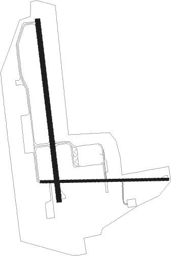
Runway info
Runway 10 / 28  | ||
| length | 612m (2008ft) | |
| bearing | 93° / 273° | |
| width | 12m (40ft) | |
| surface | asphalt | |
| displ threshold | 0m (0ft) / 31m (102ft) | |
| Runway 1 / 19 | ||
| length | 869m (2851ft) | |
| bearing | 357° / 177° | |
| width | 23m (75ft) | |
| surface | asphalt | |
| displ threshold | 0m (0ft) / 47m (154ft) | |
| blast zone | 0m (0ft) / 60m (197ft) | |
Nearby beacons
| code | identifier | dist | bearing | frequency |
|---|---|---|---|---|
| MTN | MARTIN (BALTIMORE) TACAN | 17.1 | 222° | 134.10 |
| IL | HADIN (WILMINGTON) NDB | 27.2 | 89° | 248 |
| DQO | DUPONT (WILMINGTON) VORTAC | 28.3 | 79° | 114 |
| FND | ELLICOTT (BALTIMORE) NDB | 31.5 | 244° | 371 |
| BAL | BALTIMORE VORTAC | 31.9 | 229° | 115.10 |
| MXE | MODENA VORTAC | 32.3 | 57° | 113.20 |
| LRP | LANCASTER VOR/DME | 33.4 | 351° | 117.30 |
| EMI | WESTMINSTER VORTAC | 36.2 | 265° | 117.90 |
| ENO | SMYRNA (KENTON) VORTAC | 37.6 | 116° | 111.40 |
| BUH | ANNE ARUNDEL (FT MEADE) NDB | 38.8 | 229° | 260 |
| OOD | WOODSTOWN VORTAC | 41.8 | 86° | 112.80 |
| DOV | DOVER TACAN | 42.9 | 121° | 110 |
| PTW | POTTSTOWN VORTAC | 49.2 | 44° | 116.50 |
| MD | ENOLA (HARRISBURG) NDB | 51.9 | 314° | 204 |
| CX | LATLE (HARRISBURG) NDB | 52.1 | 307° | 219 |
| ING | AMBLER NDB | 54 | 59° | 275 |
| BZJ | BELLGROVE (INDIANTOWN GAP) NDB | 54.6 | 338° | 328 |
| ADW | ANDREWS (CAMP SPRINGS) VORTAC | 55.1 | 221° | 113.10 |
| GTN | GEORGETOWN (WASH., D.C.) NDB | 57.4 | 235° | 323 |
| DCA | WASHINGTON, D.C. VOR/DME | 57.5 | 230° | 111 |
| OTT | NOTTINGHAM VORTAC | 57.5 | 212° | 113.70 |
| HAR | HARRISBURG VORTAC | 59.5 | 310° | 112.50 |
| DCA | OXONN (WASHINGTON) NDB | 61.5 | 226° | 332 |
| RAV | RAVINE VORTAC | 61.9 | 338° | 114.60 |
| ATR | WATERLOO VOR/DME | 64.7 | 127° | 112.60 |
| DAA | DAVEE (FT BELVOIR) NDB | 68.8 | 225° | 223 |
Instrument approach procedures
| runway | airway (heading) | route (dist, bearing) |
|---|---|---|
| RWNVB | KITHE (159°) | KITHE TAYLO (12mi, 228°) 3000ft SNAZI (6mi, 154°) 2900ft |
| RWNVB | TAFFI (87°) | TAFFI SNAZI (10mi, 81°) 2900ft |
| RNAV | SNAZI 2900ft MARRY (5mi, 93°) 2000ft 0W3 (5mi, 92°) 449ft (4769mi, 117°) 812ft ILINE (4766mi, 297°) CURVY (7mi, 63°) 3000ft CURVY (turn) 3000ft |
Disclaimer
The information on this website is not for real aviation. Use this data with the X-Plane flight simulator only! Data taken with kind consent from X-Plane 12 source code and data files. Content is subject to change without notice.