Greenwood Wonder Lake - Galt
Airport details
| Country | United States of America |
| State | Illinois |
| Region | K5 |
| Airspace | Chicago Ctr |
| Municipality | McHenry County |
| Elevation | 875ft (267m) |
| Timezone | GMT -6 |
| Coordinates | 42.40289, -88.37511 |
| Magnetic var | |
| Type | land |
| Available since | X-Plane v10.40 |
| ICAO code | 10C |
| IATA code | n/a |
| FAA code | 10C |
Communication
| Galt CTAF/UNICOM | 122.800 |
| Galt AI Tower | 128.800 |
| Galt CHICAGO Approach/Departure | 120.550 |
Nearby Points of Interest:
Terwilliger House
-George Stickney House
-Lucien Boneparte Covell House
-Memorial Hall
-Old McHenry County Courthouse
-Meyerhofer Cobblestone House
-David Hall House
-Redwood Cottage
-The Riviera
-Main Street Historic District
-Horticultural Hall
-Orson Rogers House
-Charles H. Hibbard House
-Christian Geister House
-Fred B. Jones House
-A. P. Johnson House
-Burlington Community Swimming Pools and Bathhouse
-Edward Elderkin House
-Elkhorn Municipal Building
-St. Mary's Church of Gilberts
-Reynolds-Weed House
-John and Margaret Bell House
-Jewel Tea Company, Inc. building
-Octagon House
-Delavan Post Office
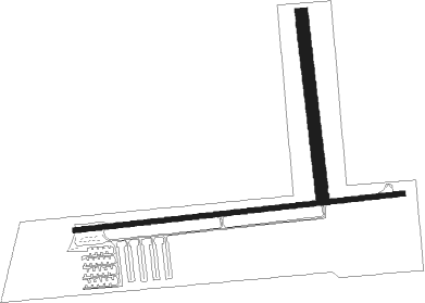
Runway info
Runway 9 / 27  | ||
| length | 1008m (3307ft) | |
| bearing | 89° / 269° | |
| width | 15m (50ft) | |
| surface | asphalt | |
| displ threshold | 125m (410ft) / 0m (0ft) | |
| Runway 18 / 36 | ||
| length | 555m (1821ft) | |
| bearing | 177° / 357° | |
| width | 38m (125ft) | |
| surface | grass | |
Nearby beacons
| code | identifier | dist | bearing | frequency |
|---|---|---|---|---|
| BUU | (BURLINGTON) DME | 17.5 | 14° | 114.50 |
| OBK | NORTHBROOK VOR/DME | 21.7 | 113° | 113 |
| ENW | DME | 22.8 | 66° | 109.20 |
| UG | WAUKE (CHICAGO/WAUKEGAN) NDB | 25.6 | 84° | 379 |
| RA | PASER (RACINE) NDB | 26.9 | 60° | 206 |
| DPA | DUPAGE (CHICAGO) VOR/DME | 30.8 | 177° | 108.40 |
| GCO | DME | 32.3 | 131° | 108.25 |
| HRK | (RACINE) DME | 32.8 | 57° | 117.70 |
| JVL | JANESVILLE VOR/DME | 33.6 | 282° | 114.30 |
| RFD | DME | 38.1 | 258° | 110.80 |
| BAE | BADGER (MILWAUKEE) VOR/DME | 43 | 7° | 116.40 |
| LJT | (MILWAUKEE) DME | 44.9 | 26° | 115.65 |
| RYV | ROCK RIVER (WATERTOWN) NDB | 48.7 | 336° | 371 |
| MX | KEDZI (CHICAGO) NDB | 50.1 | 134° | 248 |
| JOT | JOLIET VOR/DME | 51.4 | 176° | 112.30 |
| MSN | MADISON VORTAC | 61.5 | 308° | 108.60 |
| CGT | CHICAGO HEIGHTS VORTAC | 64.5 | 138° | 114.20 |
Instrument approach procedures
| runway | airway (heading) | route (dist, bearing) |
|---|---|---|
| RWNVB | HADAK (269°) | HADAK 3000ft |
| RWNVB | NUELG (34°) | NUELG UDZOW (31mi, 56°) 3000ft HADAK (5mi, 358°) 3000ft |
| RWNVB | VEENA (193°) | VEENA TIWRO (15mi, 145°) 3000ft HADAK (5mi, 178°) 3000ft |
| RNAV | HADAK 3000ft GENBE (5mi, 269°) 3000ft FALRA (5mi, 269°) 1540ft (5333mi, 116°) 2000ft HADAK (5323mi, 296°) 3000ft HADAK (turn) |
Disclaimer
The information on this website is not for real aviation. Use this data with the X-Plane flight simulator only! Data taken with kind consent from X-Plane 12 source code and data files. Content is subject to change without notice.