Wallkill - Kobelt
Airport details
| Country | United States of America |
| State | New York |
| Region | |
| Airspace | Boston Ctr |
| Municipality | Town of Shawangunk |
| Elevation | 418ft (127m) |
| Timezone | GMT -5 |
| Coordinates | 41.62051, -74.14317 |
| Magnetic var | |
| Type | land |
| Available since | X-Plane v10.40 |
| ICAO code | 10N |
| IATA code | n/a |
| FAA code | n/a |
Communication
| Kobelt ATC | 122.800 |
Nearby Points of Interest:
Andries DuBois House
-Cole-Hasbrouck Farm Historic District
-Dubois-Phelps House
-Gardiner Town Hall
-Bodine Farmhouse
-Reformed Church of Shawangunk
-Terwilliger House
-Jacob T. Walden Stone House
-Bevier House
-John R. Hays House
-Thaddeus Hait Farm
-Walden United Methodist Church
-Gilbert Millspaugh House
-Shuart-Van Orden Stone House
-Johannes Decker Farm
-Brykill Farms
-Bruynswick School No. 8
-Jacob Bookstaver House
-Abraham and Maria LeFevre House
-Jenkins-DuBois Farm
-John A. Lafevre House and School
-Locust Lawn Estate
-Brown Farmstead
-Benjamin Haines House
-Dill Farm
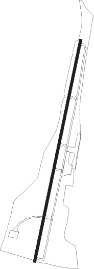
Runway info
| Runway 3 / 21 | ||
| length | 874m (2867ft) | |
| bearing | 21° / 201° | |
| width | 11m (35ft) | |
| surface | asphalt | |
| displ threshold | 37m (121ft) / 0m (0ft) | |
Nearby beacons
| code | identifier | dist | bearing | frequency |
|---|---|---|---|---|
| SKU | STANWYCK (NEWBURGH) NDB | 7 | 133° | 261 |
| SW | NEELY (NEWBURGH) NDB | 8.9 | 212° | 335 |
| IGN | KINGSTON VOR/DME | 14.6 | 82° | 117.60 |
| HUO | HUGUENOT VOR/DME | 23.8 | 245° | 116.10 |
| PWL | PAWLING (POUGHKEEPSIE) VOR/DME | 25.9 | 75° | 114.30 |
| CMK | CARMEL VOR/DME | 32.5 | 121° | 116.60 |
| SAX | SPARTA VORTAC | 37.6 | 216° | 115.70 |
| PFH | PHILMONT (HUDSON) NDB | 42.3 | 34° | 272 |
| MM | MOREE (MORRISTOWN) NDB | 45.3 | 194° | 392 |
| TEB | TETERBORO VOR/DME | 46.4 | 174° | 108.40 |
| TE | TORBY (TETERBORO) NDB | 49 | 179° | 214 |
| DNY | DE LANCEY VOR/DME | 49.4 | 304° | 112.10 |
| STW | STILLWATER VOR/DME | 49.7 | 229° | 109.60 |
| LGA | LA GUARDIA (NEW YORK) VOR/DME | 51.7 | 162° | 113.10 |
| CAT | CHATHAM NDB | 54.3 | 198° | 254 |
| BWZ | BROADWAY (SCHOOLEY'S MT) VOR/DME | 58.1 | 220° | 114.20 |
| FR | FRIKK (FARMINGDALE) NDB | 58.8 | 142° | 407 |
| JFK | KENNEDY (NEW YORK) VOR/DME | 61.6 | 159° | 115.90 |
| DPK | DEER PARK VOR/DME | 62.5 | 135° | 117.70 |
Disclaimer
The information on this website is not for real aviation. Use this data with the X-Plane flight simulator only! Data taken with kind consent from X-Plane 12 source code and data files. Content is subject to change without notice.