Brewton - Brewton Muni
Airport details
| Country | United States of America |
| State | Alabama |
| Region | K7 |
| Airspace | Jacksonville Ctr |
| Municipality | Brewton |
| Elevation | 99ft (30m) |
| Timezone | GMT -6 |
| Coordinates | 31.05083, -87.06597 |
| Magnetic var | |
| Type | land |
| Available since | X-Plane v10.40 |
| ICAO code | 12J |
| IATA code | n/a |
| FAA code | n/a |
Communication
| Brewton Muni AWOS 3 | 119.325 |
| Brewton Muni CTAF/UNICOM | 122.725 |
Nearby Points of Interest:
Alger-Sullivan Lumber Company Residential Historic District
-Asa Johnston Farmhouse
-Louisville and Nashville Depot
-New Evergreen Commercial Historic District
-Milton Historic District
-Mt. Pilgrim African Baptist Church
-Ollinger-Cobb House
-Arcadia Sawmill and Arcadia Cotton Mill
-Crestview Commercial Historic District
-Bank of Andalusia
-Covington County Courthouse and Jail
Runway info
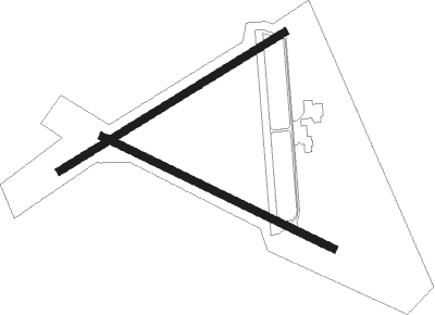
Runway 12 / 30  | ||
| length | 1526m (5007ft) | |
| bearing | 117° / 297° | |
| width | 46m (150ft) | |
| surface | asphalt | |
| Runway 6 / 24 | ||
| length | 1567m (5141ft) | |
| bearing | 66° / 246° | |
| width | 46m (150ft) | |
| surface | asphalt | |
Nearby beacons
| code | identifier | dist | bearing | frequency |
|---|---|---|---|---|
| NSE | WHITING (MILTON) TACAN | 19.7 | 172° | 112.30 |
| CEW | CRESTVIEW VORTAC | 24 | 120° | 115.90 |
| NGS | SANTA ROSA (MILTON) TACAN | 26.9 | 164° | 133.60 |
| MVC | MONROEVILLE VORTAC | 28.6 | 325° | 116.80 |
| CE | KOBRA (CRESTVIEW) NDB | 29.7 | 111° | 201 |
| PKZ | PICKENS (PENSACOLA) NDB | 37.3 | 190° | 326 |
| NUN | SAUFLEY (PENSACOLA) VOR | 37.4 | 205° | 108.80 |
| JUY | JUDD (ANDALUSIA) NDB | 37.8 | 69° | 264 |
| HRT | HURLBURT (MARY ESTHER) TACAN | 42.1 | 149° | 110.80 |
| NPA | PENSACOLA TACAN | 43.5 | 200° | 117.20 |
| DWG | WARRINGTON (VALPARAISO) TACAN | 44.4 | 136° | 134.50 |
| BFM | BROOKLEY (MOBILE) VORTAC | 57.4 | 246° | 112.80 |
| TOI | BLOOD (TROY) NDB | 67.9 | 51° | 365 |
Instrument approach procedures
| runway | airway (heading) | route (dist, bearing) |
|---|---|---|
| RW06 | EMUSY (87°) | EMUSY 2000ft ODAZO (5mi, 149°) 2000ft |
| RW06 | ODAZO (67°) | ODAZO 2000ft |
| RNAV | ODAZO 2000ft AZEBE (6mi, 66°) 1800ft 12J (6mi, 68°) 121ft (5254mi, 110°) 500ft ODAZO (5265mi, 290°) 2000ft ODAZO (turn) | |
| RW12 | ARUYY (116°) | ARUYY 1900ft |
| RW12 | REVBE (96°) | REVBE 3000ft ARUYY (5mi, 34°) 1900ft |
| RW12 | SOXCO (138°) | SOXCO 2300ft ARUYY (5mi, 214°) 1900ft |
| RNAV | ARUYY 1900ft EHEBA (6mi, 116°) 1900ft 12J (6mi, 115°) 128ft MIEGE (6mi, 118°) HOLBI (7mi, 214°) ODAZO (12mi, 285°) 2000ft ODAZO (turn) | |
| RW24 | CUMAT (265°) | CUMAT 2300ft MOFEB (5mi, 329°) 1900ft |
| RW24 | HEBLI (224°) | HEBLI 2000ft MOFEB (5mi, 149°) 1900ft |
| RW24 | MOFEB (245°) | MOFEB 1900ft |
| RNAV | MOFEB 1900ft QEPGY (6mi, 246°) 1900ft 12J (6mi, 245°) 123ft ODAZO (12mi, 247°) 2000ft ODAZO (turn) | |
| RW30 | HAVOG (276°) | HAVOG 2000ft YADUC (5mi, 214°) 1800ft |
| RW30 | YADUC (297°) | YADUC 1800ft |
| RNAV | YADUC 1800ft MIEGE (6mi, 296°) 1800ft 12J (6mi, 298°) 136ft EHEBA (6mi, 295°) ODAZO (10mi, 218°) 2000ft ODAZO (turn) |
Disclaimer
The information on this website is not for real aviation. Use this data with the X-Plane flight simulator only! Data taken with kind consent from X-Plane 12 source code and data files. Content is subject to change without notice.