Andover - Aeroflex Andover
Airport details
| Country | United States of America |
| State | New Jersey |
| Region | K6 |
| Airspace | New York Ctr |
| Municipality | Andover Township |
| Elevation | 583ft (178m) |
| Timezone | GMT -5 |
| Coordinates | 41.00740, -74.73923 |
| Magnetic var | |
| Type | land |
| Available since | X-Plane v10.30 |
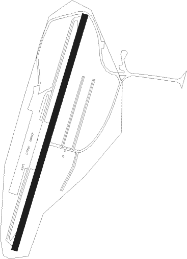
| ICAO code | 12N |
| IATA code | n/a |
| FAA code | n/a |
Communication
| AEROFLEX ANDOVER CTAF/UNICOM | 122.800 |
| AEROFLEX ANDOVER NEW YORK Approach/Departure | 127.600 |
Nearby Points of Interest:
Henry W. Merriam House
-Sussex County Courthouse
-Morris Canal
-Lake Hopatcong Yacht Club
-Casper and Abraham Shafer Grist Mill Complex
-Plaster Mill
-Rutherfurd Hall
-Harmony Hill United Methodist Church
-Backwards Tunnel
-Old Monroe School House
-Ledgewood Historic District
-Silas Riggs House
-King Store and Homestead
-Cary Station
-Mount Olive Village Historic District
-Blairstown Historic District
-Jacob C. Allen House
-Bridget Smith House
-Baker Building
-Great Meadows Railroad Station
-Lawrence Mansion
-Old Mine Road Historic District
-Bethany Chapel
-Andrew Snable House
-Friends Meetinghouse
Nearby beacons
| code | identifier | dist | bearing | frequency |
|---|---|---|---|---|
| STW | STILLWATER VOR/DME | 5.9 | 265° | 109.60 |
| SAX | SPARTA VORTAC | 9.7 | 73° | 115.70 |
| BWZ | BROADWAY (SCHOOLEY'S MT) VOR/DME | 13 | 202° | 114.20 |
| MM | MOREE (MORRISTOWN) NDB | 19.9 | 107° | 392 |
| CAT | CHATHAM NDB | 21.3 | 131° | 254 |
| HUO | HUGUENOT VOR/DME | 25 | 20° | 116.10 |
| SBJ | SOLBERG VOR/DME | 25.4 | 180° | 112.90 |
| TE | TORBY (TETERBORO) NDB | 30.1 | 108° | 214 |
| TEB | TETERBORO VOR/DME | 32.1 | 103° | 108.40 |
| FJC | ALLENTOWN VORTAC | 36.6 | 249° | 117.50 |
| SW | NEELY (NEWBURGH) NDB | 36.8 | 47° | 335 |
| LGA | LA GUARDIA (NEW YORK) VOR/DME | 41.7 | 104° | 113.10 |
| SKU | STANWYCK (NEWBURGH) NDB | 44.2 | 53° | 261 |
| CRI | CANARSIE VOR/DME | 45.1 | 115° | 112.30 |
| LVZ | WILKES-BARRE VORTAC | 45.8 | 286° | 111.60 |
| ARD | YARDLEY VOR/DME | 45.9 | 193° | 108.20 |
| COL | COLTS NECK VOR/DME | 49.4 | 140° | 115.40 |
| JFK | KENNEDY (NEW YORK) VOR/DME | 49.4 | 111° | 115.90 |
| RBV | ROBBINSVILLE VORTAC | 49.6 | 163° | 113.80 |
| ETX | EAST TEXAS VOR/DME | 50 | 246° | 110.20 |
| IGN | KINGSTON VOR/DME | 57.1 | 54° | 117.60 |
| ING | AMBLER NDB | 58.5 | 212° | 275 |
| GXU | MC GUIRE (WRIGHTSTOWN) VORTAC | 60.2 | 172° | 110.60 |
| PTW | POTTSTOWN VORTAC | 60.2 | 226° | 116.50 |
| NEL | LAKEHURST NDB | 60.6 | 157° | 396 |
| NEL | LAKEHURST TACAN | 60.8 | 158° | 111.80 |
Instrument approach procedures
| runway | airway (heading) | route (dist, bearing) |
|---|---|---|
| RW03 | HOPED (44°) | HOPED 3000ft |
| RW03 | MUGZY (96°) | MUGZY PEPLE (7mi, 174°) 3100ft HOPED (5mi, 119°) 3000ft |
| RW03 | SAX (253°) | SAX NOLAA (18mi, 225°) 3000ft HOPED (5mi, 299°) 3000ft |
| RNAV | HOPED 3000ft LYART (5mi, 44°) 2300ft AXULE (1mi, 44°) 1820ft MANTU (4mi, 44°) 663ft (4717mi, 119°) 983ft HOPED (4721mi, 299°) 3000ft HOPED (turn) |
Disclaimer
The information on this website is not for real aviation. Use this data with the X-Plane flight simulator only! Data taken with kind consent from X-Plane 12 source code and data files. Content is subject to change without notice.