Lakeview - Lakeview Arpt Griffith Fld
Airport details
| Country | United States of America |
| State | Michigan |
| Region | K5 |
| Airspace | Chicago Ctr |
| Municipality | Lakeview |
| Elevation | 969ft (295m) |
| Timezone | GMT -5 |
| Coordinates | 43.45225, -85.26464 |
| Magnetic var | |
| Type | land |
| Available since | X-Plane v10.40 |
| ICAO code | 13C |
| IATA code | n/a |
| FAA code | 13C |
Communication
| LAKEVIEW ARPT GRIFFITH FLD CTAF/UNICOM | 122.800 |
| LAKEVIEW ARPT GRIFFITH FLD GRAND RAPIDS Approach/Departure | 124.600 |
Nearby Points of Interest:
Giles Gilbert House
-Elk Rapids Township Hall
-Greenville Downtown Historic District
-Nisbett Building
-Fairman Building
-Sherman City Union Church
-Lincoln Road–Pine River Bridge
-Pere Marquette Railway Belding Depot
-Alvah N. Belding Memorial Library
-Mount Pleasant Indian Industrial Boarding School
-Michigan Condensed Milk Factory
-MacLachlan Sanitarium
-Mount Pleasant Downtown Historic District
-Doughty House (Mount Pleasant, Michigan)
-Alma Downtown Historic District
-Wright Opera House
-St. John the Baptist Catholic Church Complex
-George and Martha Hitchcock House
-William H. VanderHeyden House
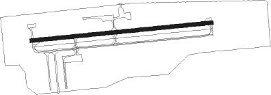
Runway info
| Runway 10 / 28 | ||
| length | 1063m (3488ft) | |
| bearing | 89° / 269° | |
| width | 23m (75ft) | |
| surface | asphalt | |
Nearby beacons
| code | identifier | dist | bearing | frequency |
|---|---|---|---|---|
| HIC | WHITE CLOUD VOR/DME | 20.9 | 285° | 117.60 |
| MOP | MOUNT PLEASANT VOR/DME | 25.1 | 72° | 110.60 |
| GR | KNOBS (GRAND RAPIDS) NDB | 33.7 | 192° | 263 |
| MKG | MUSKEGON TACAN | 37.8 | 250° | 115.20 |
| VIO | VICTORY VOR/DME | 41.2 | 199° | 115.95 |
| MA | WEXOR (CADILLAC) NDB | 48.6 | 340° | 336 |
| MB | JEPOT (MANISTEE) NDB | 62.1 | 313° | 254 |
| MBL | DME | 65.2 | 310° | 111.40 |
| PMM | PULLMAN VOR/DME | 69.7 | 220° | 112.10 |
Instrument approach procedures
| runway | airway (heading) | route (dist, bearing) |
|---|---|---|
| RW10 | TRUFA (36°) | TRUFA AWOYU (11mi, 322°) 3000ft AWOYU (turn) 3000ft |
| RNAV | AWOYU 3000ft KAWDO (5mi, 89°) 2500ft FILAG (3mi, 89°) 1640ft 13C (2mi, 89°) 1003ft (5199mi, 117°) 1800ft TRUFA (5203mi, 297°) 3000ft TRUFA (turn) | |
| RW28 | MOP (252°) | MOP OXIWE (18mi, 243°) 3000ft |
| RW28 | TRUFA (36°) | TRUFA OXIWE (17mi, 63°) 3000ft OXIWE (turn) 3000ft |
| RW28 | VANNY (290°) | VANNY OXIWE (6mi, 328°) 3000ft |
| RNAV | OXIWE 3000ft ILJAZ (3mi, 269°) 2600ft HIXEM (3mi, 269°) 1700ft 13C (2mi, 269°) 1017ft (5199mi, 117°) 1800ft TRUFA (5203mi, 297°) 3000ft TRUFA (turn) |
Disclaimer
The information on this website is not for real aviation. Use this data with the X-Plane flight simulator only! Data taken with kind consent from X-Plane 12 source code and data files. Content is subject to change without notice.