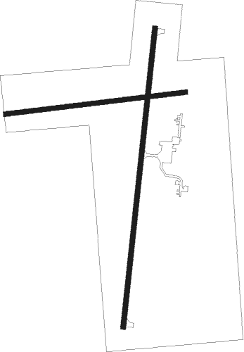
Eureka - Eureka Municipal / Lieutenant William M. Milliken
Airport details
| Country | United States of America |
| State | Kansas |
| Region | K3 |
| Airspace | Kansas City Ctr |
| Municipality | Eureka |
| Elevation | 1206ft (368m) |
| Timezone | GMT -6 |
| Coordinates | 37.85161, -96.29203 |
| Magnetic var | |
| Type | land |
| Available since | X-Plane v10.40 |
| ICAO code | 13K |
| IATA code | n/a |
| FAA code | 13K |
Communication
| Eureka Municipal / Lieutenant William M. Milliken AWOS-3 | 120.975 |
| Eureka Municipal / Lieutenant William M. Milliken CTAF/UNICOM | 122.800 |
| Eureka Municipal / Lieutenant William M. Milliken KANSAS ApproachROACH | 120.200 |
| Eureka Municipal / Lieutenant William M. Milliken KANSAS DepartureARTURE | 120.200 |
Nearby Points of Interest:
Eureka Carnegie Library
-Eureka Atchison, Topeka and Santa Fe Railroad Depot
-Robertson House (Eureka, Kansas)
-Crocker Ranch
-Woodson County Courthouse
-Stockbrands and Kemmerer Department Store
-Butler County Courthouse
-Yates Center Carnegie Library
-El Dorado Carnegie Library
-Elk Falls Pratt Truss Bridge
Nearby beacons
| code | identifier | dist | bearing | frequency |
|---|---|---|---|---|
| EMP | EMPORIA VORTAC | 27.3 | 19° | 112.80 |
| CNU | CHANUTE VOR/DME | 35.8 | 108° | 109.20 |
| IAB | MC CONNELL (WICHITA) TACAN | 48.3 | 257° | 116.50 |
| CA | HARVS (NEWTON) NDB | 49.7 | 287° | 395 |
| HRU | HERINGTON NDB | 56.1 | 328° | 407 |
Instrument approach procedures
| runway | airway (heading) | route (dist, bearing) |
|---|---|---|
| RW18 | AGEXY (161°) | AGEXY REKSE (12mi, 131°) 3200ft |
| RW18 | EMP (199°) | EMP REKSE (15mi, 204°) 3200ft |
| RW18 | FOWNE (245°) | FOWNE REKSE (15mi, 274°) 3200ft |
| RW18 | REKSE (193°) | REKSE 3200ft |
| RNAV | REKSE 3200ft ERURE (6mi, 193°) 3100ft 13K (6mi, 194°) 1246ft (5703mi, 111°) 1606ft KANEY (5706mi, 291°) 3200ft KANEY (turn) |
Disclaimer
The information on this website is not for real aviation. Use this data with the X-Plane flight simulator only! Data taken with kind consent from X-Plane 12 source code and data files. Content is subject to change without notice.

