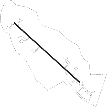
Mooresville - Lake Norman Airpark
Airport details
| Country | United States of America |
| State | North Carolina |
| Region | K7 |
| Airspace | Atlanta Ctr |
| Municipality | Iredell County |
| Elevation | 836ft (255m) |
| Timezone | GMT -5 |
| Coordinates | 35.61387, -80.89943 |
| Magnetic var | |
| Type | land |
| Available since | X-Plane v10.40 |
| ICAO code | 14A |
| IATA code | n/a |
| FAA code | n/a |
Communication
| Lake Norman Airpark CTAF/UNICOM | 122.800 |
Nearby Points of Interest:
Johnson-Neel House
-South Broad Street Row
-Espy Watts Brawley House
-Mount Mourne Plantation
-Mooresville Historic District
-Mooresville Mill Village Historic District
-George Houston House
-Hargrave House
-Davidson Historic District
-Eumenean Hall
-Philanthropic Hall, Davidson College
-Chairman Blake House
-Rankin-Sherrill House
-Beaver Dam Plantation House
-Balls Creek Campground
-Academy Hill Historic District
-Center Street A.M.E. Zion Church
-Col. Silas Alexander Sharpe House
-St. Philip's Roman Catholic Church
-United States Post Office and County Courthouse
-Iredell County Courthouse
-Statesville Commercial Historic District
-South Race Street Historic District
-Murray's Mill Historic District
-McElwee Houses
Nearby beacons
| code | identifier | dist | bearing | frequency |
|---|---|---|---|---|
| RU | ROVDY (SALISBURY) NDB | 21.2 | 74° | 275 |
| HK | TAWBA (HICKORY) NDB | 22.3 | 293° | 332 |
| BZM | BARRETTS MOUNTAIN (HICKOR VOR/DME | 22.6 | 307° | 113.75 |
| CLT | CHARLOTTE VOR/DME | 25.5 | 187° | 115 |
| GHJ | STONIA (GASTONIA) NDB | 28.3 | 211° | 260 |
| FIQ | FIDDLERS (MORGANTON) NDB | 38.1 | 277° | 391 |
| SLP | FIRST RIVER (SHELBY) NDB | 40.5 | 243° | 417 |
| VU | ALLER (ALBEMARLE) NDB | 40.5 | 99° | 346 |
| UZ | RALLY (ROCK HILL) NDB | 44.3 | 194° | 227 |
| IN | REENO (WINSTON SALEM) NDB | 45 | 58° | 317 |
| DCM | CHESTER NDB | 51.8 | 200° | 220 |
| GSO | GREENSBORO VORTAC | 51.8 | 65° | 116.20 |
| JUH | ASHEE (JEFFERSON) NDB | 53.3 | 333° | 410 |
| LKR | LANCASTER NDB | 53.5 | 177° | 400 |
| BAR | HEMLOCK (BANNER ELK) NDB | 57.6 | 299° | 320 |
| CTF | CHESTERFIELD VOR/DME | 65.4 | 147° | 108.20 |
| JJC | MOUNTAIN CITY NDB | 65.8 | 311° | 396 |
| UOT | UNION COUNTY NDB | 66.7 | 219° | 326 |
Instrument approach procedures
| runway | airway (heading) | route (dist, bearing) |
|---|---|---|
| RW14 | ZITUV (131°) | ZITUV 3000ft |
| RNAV | ZITUV 3000ft OKECU (6mi, 131°) 2500ft ITOYE (3mi, 131°) 1480ft 14A (2mi, 131°) 847ft HUBUP (3mi, 131°) LEEMO (9mi, 89°) 4000ft LEEMO (turn) |
Disclaimer
The information on this website is not for real aviation. Use this data with the X-Plane flight simulator only! Data taken with kind consent from X-Plane 12 source code and data files. Content is subject to change without notice.
