Hollandale - Hollandale Muni
Airport details
| Country | United States of America |
| State | Mississippi |
| Region | K7 |
| Airspace | Memphis Ctr |
| Municipality | Washington County |
| Elevation | 111ft (34m) |
| Timezone | GMT -6 |
| Coordinates | 33.18251, -90.83050 |
| Magnetic var | |
| Type | land |
| Available since | X-Plane v10.40 |
| ICAO code | 14M |
| IATA code | n/a |
| FAA code | n/a |
Communication
| Hollandale Muni CTAF | 122.700 |
Nearby Points of Interest:
Belmont Plantation
-Mount Holly
-Junius R. Ward House
-Leland Historic District
-Woodburn Bridge
-Washington School
-Heathman Plantation
-Lakeport Plantation
-Washington County Courthouse
-Jaketown Site
-Wetherbee House
-Greenville Commercial Historic District
-First National Bank of Greenville
-Bank of Washington
-Old Delta Democrat Times Building
-Indianola Historic District
-Dr. A.G. Anderson House
-Eudora City Hall
-American Legion Post No. 127 Building
-Holly Bluff Site
-Carlton House
-John Tushek Building
-Lake Village Commercial Historic District
-Chicot County Courthouse
-Lake Village Post Office
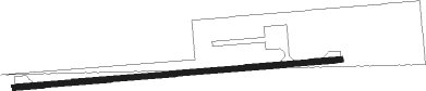
Runway info
| Runway 8 / 26 | ||
| length | 915m (3002ft) | |
| bearing | 90° / 270° | |
| width | 15m (50ft) | |
| surface | asphalt | |
Nearby beacons
| code | identifier | dist | bearing | frequency |
|---|---|---|---|---|
| MTQ | METCALF (GREENVILLE) NDB | 16.4 | 328° | 359 |
| GLH | GREENVILLE VOR/DME | 21.8 | 336° | 114.25 |
| SQS | SIDON VORTAC | 32.4 | 63° | 114.70 |
| GW | TEOCK NDB | 44.7 | 61° | 349 |
| MON | MONTICELLO VOR/DME | 49.8 | 293° | 111.60 |
| JH | BRENZ (JACKSON) NDB | 54.4 | 144° | 260 |
| TKH | TALLULAH (VICKSBURG/TALLULAH) NDB | 57.1 | 192° | 344 |
| MHZ | MAGNOLIA (MADISON) VORTAC | 58.1 | 136° | 113.20 |
| JA | ALLEN (JACKSON) NDB | 58.5 | 137° | 365 |
Disclaimer
The information on this website is not for real aviation. Use this data with the X-Plane flight simulator only! Data taken with kind consent from X-Plane 12 source code and data files. Content is subject to change without notice.