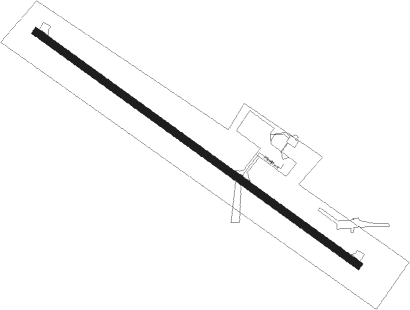
Perham - Perham Muni
Airport details
| Country | United States of America |
| State | Minnesota |
| Region | K3 |
| Airspace | Minneapolis Ctr |
| Municipality | Perham |
| Elevation | 1371ft (418m) |
| Timezone | GMT -6 |
| Coordinates | 46.61097, -95.60611 |
| Magnetic var | |
| Type | land |
| Available since | X-Plane v10.40 |
| ICAO code | 16D |
| IATA code | n/a |
| FAA code | n/a |
Communication
| PERHAM MUNI CTAF | 122.900 |
| PERHAM MUNI MINNEAPOLIS Approach | 126.100 |
| PERHAM MUNI MINNEAPOLIS Departure | 126.100 |
Nearby Points of Interest:
Perham Village Hall and Fire Station
-Craigie Flour Mill Historical Marker
-Maplewood State Park
-District No. 182 School
-Trinity Lutheran Church
-People's Union Church
-O.A.E. Blyberg House
-Prospect House
-Wadena Depot
-Wadena Fire and City Hall
-Elizabeth Village Hall and Jail
-C.J. Wright House
-C.C. Clement House
-Fergus Falls Regional Treatment Center
-Hewitt Public School
-Edward J. Devitt U.S. Courthouse and Federal Building
-Fergus Falls City Hall
-Otter Tail County Courthouse
Nearby beacons
| code | identifier | dist | bearing | frequency |
|---|---|---|---|---|
| DTL | DETROIT LAKES VOR/DME | 17.3 | 307° | 111.20 |
| PKD | RAPIDS DME | 27.9 | 62° | 110.60 |
| PK | SPIDA (PARK RAPIDS) NDB | 29.2 | 71° | 269 |
| FFM | FERGUS FALLS VOR/DME | 29.8 | 240° | 110.40 |
| FF | HAMRE (FERGUS FALLS) NDB | 30 | 229° | 337 |
| AXN | ALEXANDRIA VOR/DME | 42.1 | 150° | 112.80 |
| IDJ | LAKE BEMIDJI VOR/DME | 60.6 | 37° | 110 |
Instrument approach procedures
| runway | airway (heading) | route (dist, bearing) |
|---|---|---|
| RW13 | HIBIR (120°) | HIBIR 3200ft |
| RW13 | KITPE (150°) | KITPE 3400ft HIBIR (6mi, 231°) 3200ft |
| RW13 | LAYEB (98°) | LAYEB 3200ft HIBIR (6mi, 51°) 3200ft |
| RNAV | HIBIR 3200ft GEZTO (7mi, 120°) 3100ft ETAHE (3mi, 120°) 2200ft 16D (3mi, 120°) 1421ft (5636mi, 116°) 1671ft ILUZY (5628mi, 296°) 3000ft ILUZY (turn) | |
| RW31 | ILUZY (300°) | ILUZY 3000ft |
| RW31 | INXAL (278°) | INXAL 3400ft ILUZY (6mi, 231°) 3000ft |
| RW31 | JORVO (331°) | JORVO 3100ft ILUZY (6mi, 51°) 3000ft |
| RNAV | ILUZY 3000ft UJOTO (7mi, 300°) 3000ft 16D (5mi, 300°) 1416ft (5636mi, 116°) 1666ft HIBIR (5645mi, 296°) 3200ft HIBIR (turn) |
Disclaimer
The information on this website is not for real aviation. Use this data with the X-Plane flight simulator only! Data taken with kind consent from X-Plane 12 source code and data files. Content is subject to change without notice.
