Dawson - Dawson Muni
Airport details
| Country | United States of America |
| State | Georgia |
| Region | K7 |
| Airspace | Jacksonville Ctr |
| Municipality | Terrell County |
| Elevation | 333ft (101m) |
| Timezone | GMT -5 |
| Coordinates | 31.74328, -84.41930 |
| Magnetic var | |
| Type | land |
| Available since | X-Plane v10.40 |
| ICAO code | 16J |
| IATA code | n/a |
| FAA code | n/a |
Communication
| Dawson Muni CTAF/UNICOM | 122.800 |
| Dawson Muni JACKSONVILLE Approach/Departure | 125.750 |
Nearby Points of Interest:
Shellman Historic District
-Leesburg Depot
-Lee County Courthouse
-Boyd Mill Place
-John A. Davis House
-Liberty Hall Plantation
-United States Post Office and Courthouse
-Albany Municipal Auditorium
-Samuel Farkas House
-Heritage Plaza
-Albany Theatre
-Rosenberg Brothers Department Store
-Nelson Tift Building
-Bridge House
-Fletcher Henderson House
-Webster County Jails
-Webster County Courthouse
-Richland Historic District
-South Railroad Historic District
-George W. Jackson House
-Baker County Courthouse
-Stewart County Courthouse
-Schley County Courthouse
-Sylvester Local News
-Worth County Courthouse
Runway info
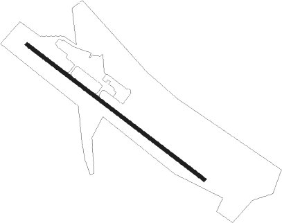
| Runway 13 / 31 | ||
| length | 1375m (4511ft) | |
| bearing | 127° / 307° | |
| width | 23m (75ft) | |
| surface | asphalt | |
| blast zone | 31m (102ft) / 0m (0ft) | |
Nearby beacons
| code | identifier | dist | bearing | frequency |
|---|---|---|---|---|
| PZD | PECAN (ALBANY) VOR/DME | 8.3 | 125° | 116.10 |
| ACJ | SOUTHER (AMERICUS) NDB | 25.1 | 32° | 242 |
| LKG | LINDBERGH (AMERICUS) NDB | 30.3 | 36° | 242 |
| OHY | CONEY (CORDELE) NDB | 32.2 | 65° | 400 |
| EUF | EUFAULA VORTAC | 38.3 | 286° | 109.20 |
| IZS | MONTEZUMA NDB | 42.9 | 33° | 426 |
| AWS | LAWSON (COLUMBUS) NDB | 45.1 | 312° | 335 |
| LSF | LAWSON (COLUMBUS) VOR/DME | 45.8 | 316° | 111.40 |
| LYZ | WILLIS (BAINBRIDGE) NDB | 46.6 | 188° | 359 |
| MGR | DME | 50.6 | 137° | 108.80 |
| IFM | TIFT MYERS (TIFTON) VOR | 51.2 | 109° | 112.50 |
| CS | FENIX (COLUMBUS) NDB | 53 | 319° | 355 |
| CYR | CAIDY (CAIRO) NDB | 53 | 163° | 338 |
| VNA | VIENNA VORTAC | 54.8 | 63° | 116.50 |
| GTP | PATON (THOMASVILLE) NDB | 56.1 | 143° | 245 |
| CSG | COLUMBUS VORTAC | 60.5 | 326° | 117.10 |
| SMY | SOYYA (MARIANNA) NDB | 66.7 | 223° | 329 |
| MAI | MARIANNA VORTAC | 67.9 | 216° | 114 |
| WRB | ROBINS (WARNER ROBINS) TACAN | 68.4 | 43° | 135.30 |
| MCN | MACON VORTAC | 69.1 | 39° | 114.20 |
Instrument approach procedures
| runway | airway (heading) | route (dist, bearing) |
|---|---|---|
| RW32 | PZD (305°) | PZD 2900ft |
| RNAV | PZD 2900ft FANOG (3mi, 305°) 1920ft 16J (5mi, 305°) 329ft (5120mi, 111°) 732ft PZD (5114mi, 291°) 2900ft PZD (turn) 2900ft |
Disclaimer
The information on this website is not for real aviation. Use this data with the X-Plane flight simulator only! Data taken with kind consent from X-Plane 12 source code and data files. Content is subject to change without notice.