Myrtle Creek - Myrtle Creek Muni
Airport details
| Country | United States of America |
| State | Oregon |
| Region | |
| Airspace | Seattle Ctr |
| Municipality | Douglas County |
| Elevation | 620ft (189m) |
| Timezone | GMT -8 |
| Coordinates | 42.99779, -123.31446 |
| Magnetic var | |
| Type | land |
| Available since | X-Plane v10.40 |
| ICAO code | 16S |
| IATA code | n/a |
| FAA code | 16S |
Communication
Nearby Points of Interest:
Canyonville United Methodist Church
-China Ditch
-Mill–Pine Neighborhood Historic District
-Judge James Watson Hamilton House
-U.S. Post Office
-Roseburg National Guard Armory
-Kohlhagen Building
-Floed–Lane House
-Oregon State Soldier's Home Hospital
-James Wimer Octagonal Barn
-Tiller Ranger Station
-wolf creek inn & tavern
-Glide Ranger Station
-Sutherlin Bank Building
-Hugo Community Baptist Church
-Oakland Historic District
-Rand Ranger Station
-Zane Grey Cabin
-English Settlement School
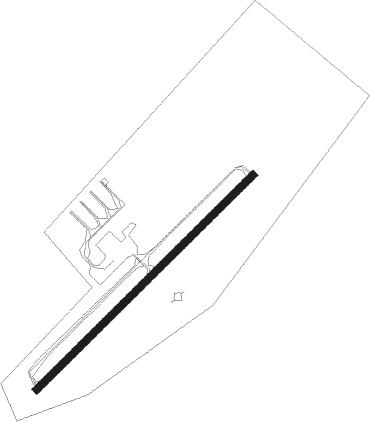
Runway info
| Runway 4 / 22 | ||
| length | 791m (2595ft) | |
| bearing | 58° / 238° | |
| width | 19m (61ft) | |
| surface | asphalt | |
Nearby beacons
| code | identifier | dist | bearing | frequency |
|---|---|---|---|---|
| RBG | ROSEBURG VOR/DME | 11.2 | 348° | 108.20 |
| OED | ROGUE VALLEY (MEDFORD) VORTAC | 35.8 | 142° | 113.60 |
| MEF | MEDFORD NDB | 41.1 | 144° | 356 |
| OTH | NORTH BEND VOR/DME | 45 | 296° | 112.10 |
| OT | EMIRE (NORTH BEND) NDB | 49.6 | 292° | 378 |
Disclaimer
The information on this website is not for real aviation. Use this data with the X-Plane flight simulator only! Data taken with kind consent from X-Plane 12 source code and data files. Content is subject to change without notice.