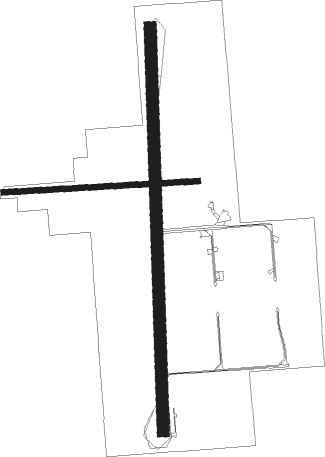
Ocala - Jumbolair
Airport details
| Country | United States of America |
| State | Florida |
| Region | K7 |
| Airspace | Jacksonville Ctr |
| Municipality | Marion County |
| Elevation | 100ft (30m) |
| Timezone | GMT -5 |
| Coordinates | 29.28025, -82.12482 |
| Magnetic var | |
| Type | land |
| Available since | X-Plane v10.40 |
| ICAO code | 17FL |
| IATA code | n/a |
| FAA code | 17FL |
Communication
| Jumbolair CTAF | 122.700 |
Nearby Points of Interest:
Coca-Cola Bottling Plant
-E. C. Smith House
-Ocala Union Station
-Tuscawilla Park Historic District
-The Ritz Apartment
-West Ocala Historic District
-Ocala Historic Commercial District
-Ocala Historic District
-Armstrong House (Citra, Florida)
-Robert W. Ferguson House
-T. W. Randall House
-Island Grove Masonic Lodge No. 125
-McIntosh Historic District
-Evinston Community Store and Post Office
-John A. King House
-Winecoff House
-Micanopy Historic District
-Orange Springs Methodist Episcopal Church and Cemetery
-James W. Townsend House
-Alfred Ayer House
-Thomas R. Ayer House
-Gen. Robert Bullock House
-Citizens Bank
-Kerr City Historic District
-James Riley Josselyn House
Nearby beacons
| code | identifier | dist | bearing | frequency |
|---|---|---|---|---|
| OCF | OCALA VORTAC | 8.1 | 225° | 113.70 |
| GN | WYNDS (GAINESVILLE) NDB | 23.5 | 353° | 269 |
| GNV | GATORS VORTAC | 25.9 | 340° | 116.20 |
| RYD | REYNOLDS (GREEN COVE SPRINGS) NDB | 47.9 | 34° | 338 |
| CTY | CROSS CITY VORTAC | 51.9 | 289° | 112 |
| NZC | CECIL TACAN | 57.9 | 15° | 114.10 |
| SGJ | SAINT AUGUSTINE VOR/DME | 58 | 50° | 109.40 |
| OR | HERNY (ORLANDO) NDB | 58.9 | 138° | 221 |
| LCQ | LAKE CITY NDB | 59.2 | 333° | 204 |
| ORL | ORLANDO VORTAC | 60.7 | 133° | 112.20 |
| NIP | JACKSONVILLE TACAN | 61.9 | 25° | 108.20 |
Instrument approach procedures
| runway | airway (heading) | route (dist, bearing) |
|---|---|---|
| RW18-M | GNV (160°) | GNV OAKEL (16mi, 145°) 2500ft |
| RW18-M | JUTTS (196°) | JUTTS OAKEL (9mi, 209°) 2500ft |
| RW18-M | OCF (45°) | OCF OAKEL (18mi, 22°) 2500ft OAKEL (turn) 2500ft |
| RNAV | OAKEL 2500ft BRONT (5mi, 183°) 1900ft LUREX (3mi, 183°) 1020ft 17FL (3mi, 188°) 136ft (4993mi, 110°) 600ft DALMO (4991mi, 290°) 2500ft DALMO (turn) | |
| RWNVA | CUSAB (337°) | CUSAB DALMO (6mi, 315°) 2500ft |
| RWNVA | JUTTS (196°) | JUTTS DALMO (30mi, 187°) 2500ft DALMO (turn) 2500ft |
| RWNVA | OCF (45°) | OCF DALMO (8mi, 118°) 2500ft DALMO (turn) 2500ft |
| RNAV | DALMO 2500ft ATLSS (5mi, 352°) 1900ft FERSO (3mi, 352°) 1160ft 17FL (2mi, 347°) 1000ft (4993mi, 110°) 1000ft OAKEL (4993mi, 290°) 2500ft OAKEL (turn) |
Disclaimer
The information on this website is not for real aviation. Use this data with the X-Plane flight simulator only! Data taken with kind consent from X-Plane 12 source code and data files. Content is subject to change without notice.

