Carefree - Sky Ranch At Carefree
Airport details
| Country | United States of America |
| State | Arizona |
| Region | K2 |
| Airspace | Albuquerque Ctr |
| Municipality | Carefree |
| Elevation | 2565ft (782m) |
| Timezone | GMT -7 |
| Coordinates | 33.81810, -111.89793 |
| Magnetic var | |
| Type | land |
| Available since | X-Plane v10.40 |
| ICAO code | 18AZ |
| IATA code | n/a |
| FAA code | 18AZ |
Communication
| Sky Ranch At Carefree AWOS | 125.625 |
| Sky Ranch At Carefree UNICOM | 122.725 |
Nearby Points of Interest:
Cave Creek Service Station
-Fountain Hills
-Roald Amundsen
-Louise Lincoln Kerr House and Studio
-Louis J. Bohn and Gertrude Lee House
-Edward L. Jones House
-Kinter K. Koontz House
-Ralph Converse House
-Little Red Schoolhouse
-E. Payne Palmer House
-Rancho Joaquina House
-Sahuaro Ranch
-Brophy College Chapel
-Phoenix Homesteads Historic District
-Manistee Ranch
-Webster Auditorium
-Catlin Court Historic District
-Floralcroft Historic District
-Rose Eisendrath House
-Phoenix Towers
-Encanto-Palmcroft Historic District
-Garfield Methodist Church
-Smurthwaite House
-Helen Anderson House
-Temple Beth Israel
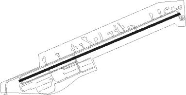
Runway info
| Runway 6 / 24 | ||
| length | 1232m (4042ft) | |
| bearing | 75° / 255° | |
| width | 15m (50ft) | |
| surface | asphalt | |
| displ threshold | 0m (0ft) / 152m (499ft) | |
| blast zone | 4m (13ft) / 0m (0ft) | |
Nearby beacons
| code | identifier | dist | bearing | frequency |
|---|---|---|---|---|
| PXR | PHOENIX VORTAC | 23.4 | 191° | 115.60 |
| LUF | LUKE (GLENDALE) TACAN | 29.4 | 240° | 113 |
| IWA | WILLIE (PHOENIX) VORTAC | 33.2 | 154° | 113.30 |
| PAN | DME | 38.3 | 52° | 116.35 |
| BXK | BUCKEYE VORTAC | 51.2 | 249° | 110.60 |
| TFD | STANFIELD (CASA GRANDE) VORTAC | 55.9 | 181° | 114.80 |
| DRK | DRAKE (PRESCOTT) VORTAC | 60.4 | 327° | 114.10 |
| GBN | GILA BEND VORTAC | 64.7 | 222° | 116.60 |
Disclaimer
The information on this website is not for real aviation. Use this data with the X-Plane flight simulator only! Data taken with kind consent from X-Plane 12 source code and data files. Content is subject to change without notice.