Hudson - Platte Valley Airpark
Airport details
| Country | United States of America |
| State | Colorado |
| Region | K2 |
| Airspace | Denver Ctr |
| Municipality | Weld County |
| Elevation | 4962ft (1512m) |
| Timezone | GMT -7 |
| Coordinates | 40.10272, -104.70119 |
| Magnetic var | |
| Type | land |
| Available since | X-Plane v10.40 |
| ICAO code | 18V |
| IATA code | n/a |
| FAA code | n/a |
Communication
| Platte Valley Airpark CTAF | 122.900 |
Nearby Points of Interest:
Beierle Farm
-United Church of Christ of Highlandlake
-Thede Farmhouse
-Longmont College
-Glazier House
-St. Stephen's Episcopal Church
-Longmont Fire Department
-Nettleton-Mead House
-First Baptist Church
-Weld County Courthouse
-Greeley Masonic Temple
-Greeley Union Pacific Railroad Depot
-Greeley Tribune Building
-Joseph A. Woodbury House
-Boulder Valley Grange No. 131
-SLW Ranch
-Bimson Blacksmith Shop
-William J. Gregory House
-Harris Park School
-Granville Fuller House
-Bowles House
-Blanche A. Wilson House
-M.J. Lavina Robidoux House
-Boulder County Poor Farm
-DeLaney Barn
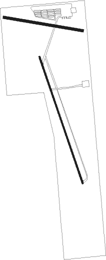
Runway info
Runway 15 / 33  | ||
| length | 1275m (4183ft) | |
| bearing | 161° / 341° | |
| width | 15m (49ft) | |
| surface | asphalt | |
| Runway 09 / 27 | ||
| length | 763m (2503ft) | |
| bearing | 101° / 281° | |
| width | 27m (90ft) | |
| surface | gravel | |
Nearby beacons
| code | identifier | dist | bearing | frequency |
|---|---|---|---|---|
| DVV | MILE HIGH (DENVER) VORTAC | 12.9 | 160° | 114.70 |
| DEN | DENVER VOR/DME | 17.5 | 172° | 117.90 |
| FN | COLLN (FT COLLINS-LOVELAND) NDB | 19.9 | 314° | 400 |
| BJC | JEFFCO (DENVER) VOR/DME | 23.1 | 247° | 115.40 |
| BKF | BUCKLEY (AURORA) TACAN | 23.8 | 187° | 109.60 |
| FQF | FALCON (DENVER) VORTAC | 25 | 169° | 116.30 |
| GLL | GILL VOR/DME | 25 | 20° | 114.20 |
Disclaimer
The information on this website is not for real aviation. Use this data with the X-Plane flight simulator only! Data taken with kind consent from X-Plane 12 source code and data files. Content is subject to change without notice.