Soldotna - Kenai River Airpark
Airport details
| Country | United States of America |
| State | Alaska |
| Region | |
| Municipality | Kenai Peninsula |
| Elevation | 200ft (61m) |
| Timezone | GMT -9 |
| Coordinates | 60.52402, -150.75800 |
| Magnetic var | |
| Type | land |
| Available since | X-Plane v10.40 |
| ICAO code | 1AK4 |
| IATA code | n/a |
| FAA code | 1AK4 |
Communication
Nearby Points of Interest:
Soldotna Post Office
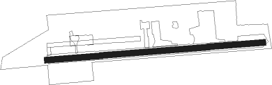
Runway info
| Runway 07 / 25 | ||
| length | 641m (2103ft) | |
| bearing | 90° / 270° | |
| width | 18m (59ft) | |
| surface | gravel | |
Nearby beacons
| code | identifier | dist | bearing | frequency |
|---|---|---|---|---|
| OLT | SOLDOTNA NDB | 4.6 | 248° | 346 |
| ENA | KENAI VOR/DME | 14 | 282° | 117.60 |
| TED | ANCHORAGE VOR/DME | 45.1 | 51° | 113.15 |
| EDF | ELMENDORF (ANCHORAGE) TACAN | 52.5 | 54° | 113.40 |
| HOM | HOMER VOR/DME | 53.2 | 221° | 114.60 |
| ACE | KACHEMAK (HOMER) NDB | 57.4 | 220° | 277 |
Disclaimer
The information on this website is not for real aviation. Use this data with the X-Plane flight simulator only! Data taken with kind consent from X-Plane 12 source code and data files. Content is subject to change without notice.