Robertsdale - Elsanor
Airport details
| Country | United States of America |
| State | Alabama |
| Region | |
| Airspace | Jacksonville Ctr |
| Municipality | Baldwin County |
| Elevation | 180ft (55m) |
| Timezone | GMT -6 |
| Coordinates | 30.54356, -87.56419 |
| Magnetic var | |
| Type | land |
| Available since | X-Plane v10.40 |
| ICAO code | 1AL4 |
| IATA code | n/a |
| FAA code | 1AL4 |
Communication
Nearby Points of Interest:
Foley Downtown Historic District
-St. Patrick's Catholic Church
-St. Paul's Episcopal Church
-Sunnyside Hotel
-Governor's Club
-Tolstoy Park
-Lebanon Chapel AME Church
-Montrose Historic District
-United States Post Office
-Street House
-Twin Beach AME Church
-Pensacola Naval Air Station Historic District
-Methodist Episcopal Church, South (Daphne, Alabama)
-North Hill Preservation District
-Crystal Ice Company Building
-James House
-Charles William Jones House
-Winston E. Arnow Federal Building
-Palafox Historic District
-United States Customs House and Post Office
-First Christian Church
-American National Bank Building
-King-Hooton House
-Louisville and Nashville Passenger Station and Express Building
-Lavalle House
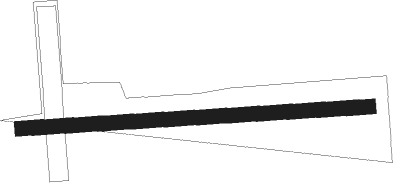
Runway info
| Runway 09 / 27 | ||
| length | 741m (2431ft) | |
| bearing | 91° / 271° | |
| width | 30m (100ft) | |
| surface | grass | |
Nearby beacons
| code | identifier | dist | bearing | frequency |
|---|---|---|---|---|
| NUN | SAUFLEY (PENSACOLA) VOR | 12.5 | 107° | 108.80 |
| NPA | PENSACOLA TACAN | 16.9 | 127° | 117.20 |
| PKZ | PICKENS (PENSACOLA) NDB | 20.9 | 105° | 326 |
| BFM | BROOKLEY (MOBILE) VORTAC | 25.7 | 278° | 112.80 |
| NSE | WHITING (MILTON) TACAN | 30.2 | 72° | 112.30 |
| NGS | SANTA ROSA (MILTON) TACAN | 32.6 | 83° | 133.60 |
| MOB | WISLE (MOBILE) NDB | 40.3 | 286° | 248 |
| SJI | SEMMES (MOBILE) VORTAC | 42.5 | 283° | 115.30 |
| HRT | HURLBURT (MARY ESTHER) TACAN | 45.7 | 98° | 110.80 |
| CEW | CRESTVIEW VORTAC | 48.7 | 72° | 115.90 |
| MVC | MONROEVILLE VORTAC | 56 | 13° | 116.80 |
| GCV | GREENE CO. (LEAKESVILLE) VORTAC | 58 | 301° | 115.70 |
Disclaimer
The information on this website is not for real aviation. Use this data with the X-Plane flight simulator only! Data taken with kind consent from X-Plane 12 source code and data files. Content is subject to change without notice.