Dexter - Dexter Regl
Airport details
| Country | United States of America |
| State | Maine |
| Region | K6 |
| Airspace | Boston Ctr |
| Municipality | Dexter |
| Elevation | 533ft (162m) |
| Timezone | GMT -5 |
| Coordinates | 45.00451, -69.23744 |
| Magnetic var | |
| Type | land |
| Available since | X-Plane v10.40 |
| ICAO code | 1B0 |
| IATA code | n/a |
| FAA code | n/a |
Communication
| Dexter Regl CTAF/UNICOM | 122.800 |
| Dexter Regl BANGOR Approach/Departure | 118.925 |
Nearby Points of Interest:
Abbott Memorial Library
-Stewart Free Library
-Observer Building
-James Sullivan Wiley House
-Guilford Memorial Library
-Pittsfield Public Library
-Former Free Will Baptist Church
-Milo Public Library
-Monson Engine House
-Swedish Lutheran Church
-Jones P. Veazie House
-Bangor Fire Engine House No. 6
-Morse & Co. Office Building
-Charles G. Bryant Double House
-Wardwell-Trickey Double House
-Bangor Theological Seminary
-Bangor Public Library
-Gen. John Williams House
-Orono Bog
-Hampden Academy
-Adams-Pickering Block
-Wheelwright Block
-Jonas Cutting–Edward Kent House
-Zebulon Smith House
-Charles W. Jenkins House
Runway info
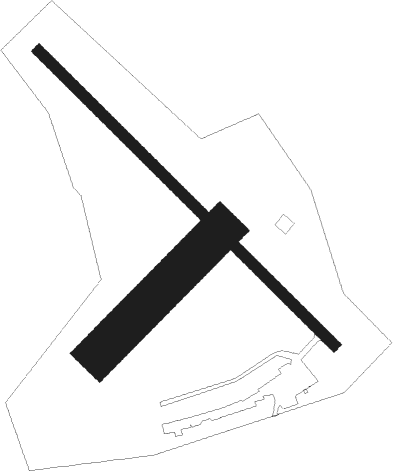
Runway 16 / 34  | ||
| length | 916m (3005ft) | |
| bearing | 130° / 310° | |
| width | 24m (80ft) | |
| surface | asphalt | |
| Runway 07 / 25 | ||
| length | 379m (1243ft) | |
| bearing | 58° / 238° | |
| width | 91m (300ft) | |
| surface | grass | |
Nearby beacons
| code | identifier | dist | bearing | frequency |
|---|---|---|---|---|
| BGR | BANGOR VORTAC | 18.2 | 114° | 114.80 |
| BUP | BURNHAM (PITTSFIELD) NDB | 19.1 | 202° | 348 |
| AU | DUNNS (AUGUSTA) NDB | 44.4 | 226° | 366 |
| MLT | MILLINOCKET VOR/DME | 46.3 | 51° | 117.90 |
| AUG | AUGUSTA VOR/DME | 47.5 | 219° | 114.95 |
| LNT | MILNOT (MILLINOCKET) NDB | 48.3 | 47° | 344 |
| SUH | SPRUCEHEAD (OWLS HEAD) NDB | 57.5 | 172° | 356 |
Instrument approach procedures
| runway | airway (heading) | route (dist, bearing) |
|---|---|---|
| RW16 | ANSYN (71°) | ANSYN ZEVAT (29mi, 55°) 3500ft ANUDE (6mi, 73°) 3000ft |
| RW16 | AUG (39°) | AUG ZEVAT (48mi, 20°) 3000ft ANUDE (6mi, 73°) 3000ft |
| RW16 | WRAPT (168°) | WRAPT DEEBA (17mi, 185°) 5000ft ANUDE (7mi, 186°) 3000ft |
| RNAV | ANUDE 3000ft FERIM (5mi, 129°) 2000ft 1B0 (5mi, 130°) 561ft (4533mi, 123°) 933ft ATVUW (4524mi, 303°) 3000ft ATVUW (turn) | |
| RW34 | ATVUW (309°) | ATVUW 3000ft |
| RW34 | BGR (294°) | BGR ATVUW (9mi, 278°) 3000ft |
| RW34 | RAZZR (24°) | RAZZR WUGES (38mi, 45°) 3000ft ATVUW (8mi, 0°) 3000ft |
| RNAV | ATVUW 3000ft IKMOW (6mi, 310°) 2000ft 1B0 (5mi, 309°) 564ft (4533mi, 123°) 933ft ATVUW (4524mi, 303°) 3000ft ATVUW (turn) |
Disclaimer
The information on this website is not for real aviation. Use this data with the X-Plane flight simulator only! Data taken with kind consent from X-Plane 12 source code and data files. Content is subject to change without notice.