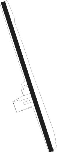
Mendon - Hopedale Industrial Park
Airport details
| Country | United States of America |
| State | Massachusetts |
| Region | K6 |
| Airspace | Boston Ctr |
| Municipality | Hopedale |
| Elevation | 269ft (82m) |
| Timezone | GMT -5 |
| Coordinates | 42.10649, -71.51009 |
| Magnetic var | |
| Type | land |
| Available since | X-Plane v10.40 |
| ICAO code | 1B6 |
| IATA code | n/a |
| FAA code | n/a |
Communication
| Hopedale Industrial Park CTAF/Unicom | 122.800 |
| Hopedale Industrial Park BRADLEY Approach/Departure | 119.000 |
Nearby Points of Interest:
Nathan C. Aldrich House and Resthaven Chapel
-Hopedale Village Historic District
-Mendon Center Historic District
-Bancroft Memorial Library
-Prospect Heights Historic District
-Gillon Block
-Thom Block
-Memorial Hall
-Milford Town Hall
-North Avenue Rural Historic District
-Richard Sayles House
-East Blackstone Friends Meetinghouse
-Southwick-Daniels Farm
-East Blackstone Village Historic District
-Azariah Newton House
-Benjamin Thayer House
-Rabbit Hill Historic District
-W. Aldrich House
-E. Albee House
-Wheelockville District
-Franklin Common Historic District
-Granite Store
-Chestnut Hill Meetinghouse
-Farnum's Gate Historic District
-R. Farnum House
Runway info
| Runway 18 / 36 | ||
| length | 968m (3176ft) | |
| bearing | 162° / 342° | |
| width | 27m (89ft) | |
| surface | asphalt | |
| displ threshold | 94m (308ft) / 34m (112ft) | |
Nearby beacons
| code | identifier | dist | bearing | frequency |
|---|---|---|---|---|
| OW | STOGE (NORWOOD) NDB | 17 | 88° | 397 |
| PUT | PUTNAM VOR/DME | 17.4 | 246° | 117.40 |
| PVD | PROVIDENCE VOR/DME | 23.2 | 168° | 115.60 |
| BOS | BOSTON VOR/DME | 27.6 | 64° | 112.70 |
| GDM | GARDNER VOR/DME | 35.8 | 309° | 110.60 |
| ORW | NORWICH VOR/DME | 39.6 | 222° | 110 |
| LWM | DME | 42.2 | 33° | 112.50 |
| MJ | FITZY (MANCHESTER) NDB | 45.5 | 359° | 209 |
| MHT | MANCHESTER VOR/DME | 46.1 | 10° | 114.40 |
| FMH | OTIS (FALMOUTH) TACAN | 52 | 114° | 115.80 |
| GON | GROTON VOR/DME | 52.5 | 215° | 110.85 |
| EEN | DME | 53.9 | 311° | 109.40 |
| SEY | SANDY POINT (BLOCK ISLAND VOR/DME | 56.4 | 184° | 117.80 |
| MVY | MARTHA'S VINEYARD VOR/DME | 58.6 | 128° | 114.50 |
| PSM | (PORTSMOUTH) DME | 65.9 | 35° | 116.50 |
Instrument approach procedures
| runway | airway (heading) | route (dist, bearing) |
|---|---|---|
| RWNVA | GRAYM (89°) | GRAYM WISUG (16mi, 61°) 3100ft YADPU (8mi, 80°) 3100ft |
| RWNVA | YADPU (162°) | YADPU 3100ft |
| RNAV | YADPU 3100ft ZAMKI (7mi, 162°) 2000ft HOPUL (3mi, 162°) 1040ft 1B6 (2mi, 162°) 309ft (4588mi, 120°) 669ft GRIPE (4606mi, 300°) 3000ft GRIPE (turn) |
Disclaimer
The information on this website is not for real aviation. Use this data with the X-Plane flight simulator only! Data taken with kind consent from X-Plane 12 source code and data files. Content is subject to change without notice.
