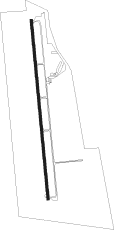
Ardmore Downtown Exec
Airport details
| Country | United States of America |
| State | Oklahoma |
| Region | K4 |
| Airspace | Ft Worth Ctr |
| Municipality | Ardmore |
| Elevation | 844ft (257m) |
| Timezone | GMT -6 |
| Coordinates | 34.14697, -97.12267 |
| Magnetic var | |
| Type | land |
| Available since | X-Plane v10.32 |
| ICAO code | 1F0 |
| IATA code | n/a |
| FAA code | n/a |
Communication
| Ardmore Downtown Exec AWOS 3 | 118.150 |
| Ardmore Downtown Exec CTAF/UNICOM | 122.700 |
Nearby Points of Interest:
Black Theater of Ardmore
-Ardmore Historic Commercial District
-Ardmore Carnegie Library
-Love County Courthouse
-Love County Jail and Sheriff's Residence
-Marshall County Courthouse
-Murray County Courthouse
-Bethel Missionary Baptist Church
-Spanish Fort
Nearby beacons
| code | identifier | dist | bearing | frequency |
|---|---|---|---|---|
| ADM | ARDMORE VORTAC | 4.4 | 325° | 116.70 |
| AI | ADDMO (ARDMORE) NDB | 10.7 | 66° | 400 |
| DNI | DENISON (SHERMAN-DENISON) NDB | 29.6 | 125° | 341 |
| URH | (DURANT) DME | 38.3 | 106° | 114.30 |
| DUC | DME | 41.9 | 287° | 111 |
| UKW | BOWIE VORTAC | 50.6 | 229° | 117.15 |
| DT | PINCK (DENTON) NDB | 52 | 185° | 257 |
| BYP | BONHAM VORTAC | 57.4 | 124° | 114.60 |
Instrument approach procedures
| runway | airway (heading) | route (dist, bearing) |
|---|---|---|
| RW17 | ADM (145°) | ADM VILLE (9mi, 15°) 3000ft VILLE (turn) 3000ft |
| RW17 | JULKU (206°) | JULKU VILLE (7mi, 249°) 3000ft |
| RW17 | ZALUN (156°) | ZALUN VILLE (7mi, 117°) 3000ft |
| RNAV | VILLE 3000ft KALVY (7mi, 179°) 2600ft 1F0 (6mi, 179°) 890ft (5759mi, 109°) 1245ft VAAMP (5760mi, 289°) 3000ft VAAMP (turn) | |
| RW35 | ADM (145°) | ADM VAAMP (17mi, 170°) 3000ft VAAMP (turn) 3000ft |
| RNAV | VAAMP 3000ft AUSTE (7mi, 359°) 2500ft WIKVO (2mi, 359°) 1700ft 1F0 (3mi, 359°) 885ft (5759mi, 109°) 1200ft VILLE (5758mi, 289°) 3000ft VILLE (turn) |
Disclaimer
The information on this website is not for real aviation. Use this data with the X-Plane flight simulator only! Data taken with kind consent from X-Plane 12 source code and data files. Content is subject to change without notice.