Munroe Falls - Kent State University
Airport details
| Country | United States of America |
| State | Ohio |
| Region | K5 |
| Airspace | Cleveland Ctr |
| Municipality | Stow |
| Elevation | 1148ft (350m) |
| Timezone | GMT -5 |
| Coordinates | 41.15139, -81.41511 |
| Magnetic var | |
| Type | land |
| Available since | X-Plane v10.40 |
| ICAO code | 1G3 |
| IATA code | n/a |
| FAA code | n/a |
Communication
| Kent State University CTAF/UNICOM | 122.725 |
| Kent State University AKRON CANTON Approach/Departure | 118.600 |
Nearby Points of Interest:
Kent Jail
-West Main Street District
-Charles Kent House
-John Davey House
-Masonic Temple
-Kent Industrial District
-Franklin Township Hall
-Aaron Ferrey House
-Ohio State Normal College At Kent
-Francis D. Alling House
-First Congregational Church of Cuyahoga Falls
-Michael Duffy Farm
-Hudson Historic District
-Goodyear Hall-Ohio Savings and Trust Company
-St. Paul's Sunday School and Parish House
-Cascade Locks Historic District
-Eagles Temple
-Akron Post Office and Federal Building
-Akron Public Library
-The Gothic Building
-Virginia Kendall State Park Historic District
-Huntington Tower
-Summit County Courthouse
-Akron Rural Cemetery Buildings
-Akron YMCA Building
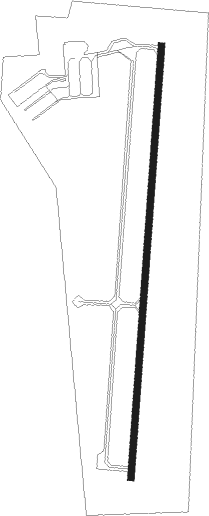
Runway info
| Runway 1 / 19 | ||
| length | 1221m (4006ft) | |
| bearing | 11° / 191° | |
| width | 18m (59ft) | |
| surface | asphalt | |
| displ threshold | 15m (49ft) / 0m (0ft) | |
Nearby beacons
| code | identifier | dist | bearing | frequency |
|---|---|---|---|---|
| AK | AKRON NDB | 5 | 161° | 362 |
| ACO | AKRON VOR/DME | 10 | 102° | 114.40 |
| BSV | BRIGGS VOR/DME | 24.6 | 182° | 112.40 |
| CXR | CHARDON VOR/DME | 24.7 | 35° | 112.70 |
| BF | TABEY (CLEVELAND) NDB | 26 | 339° | 248 |
| LQL | LAKELAND (WILLOUGHBY) NDB | 31.9 | 4° | 263 |
| YNG | YOUNGSTOWN VORTAC | 35.1 | 76° | 109 |
| DJB | DRYER VOR/DME | 35.9 | 285° | 113.60 |
| YN | FETCH (YOUNGSTOWN/WARREN) NDB | 37.1 | 87° | 338 |
| UCP | CASTLE (NEW CASTLE) NDB | 45.8 | 97° | 272 |
| JFN | JEFFERSON VOR/DME | 47.3 | 48° | 115.20 |
| CTW | DME | 55.4 | 184° | 111.80 |
| CFX | CADIZ NDB | 57.8 | 156° | 239 |
| HLG | WHEELING VOR/DME | 65.9 | 136° | 112.20 |
Departure and arrival routes
| Transition altitude | 18000ft |
| Transition level | 18000ft |
| STAR starting points | distance | inbound heading | |
|---|---|---|---|
| ALL | |||
| HUUVR1 | 31.6 | 34° | |
| BRWNZ4 | 55.3 | 131° | |
| ZZIPS1 | 12.0 | 299° | |
Instrument approach procedures
| runway | airway (heading) | route (dist, bearing) |
|---|---|---|
| RW01 | DEFOE (286°) | DEFOE BUNAC (15mi, 250°) 3000ft OMADE (5mi, 285°) 3000ft |
| RW01 | JOSEF (34°) | JOSEF OMADE (8mi, 61°) 3000ft |
| RW01 | OMADE (11°) | OMADE 3000ft |
| RNAV | OMADE 3000ft JEPMO (7mi, 11°) 2800ft 1G3 (5mi, 11°) 1159ft (5018mi, 117°) 1540ft WEXER (5017mi, 297°) 3000ft WEXER (turn) | |
| RW19 | IXORE (137°) | IXORE WEXER (10mi, 91°) 3000ft WEXER (turn) 3000ft |
| RNAV | WEXER 3000ft KENWU (6mi, 191°) 2800ft PAGIC (3mi, 191°) 1700ft 1G3 (2mi, 191°) 1174ft (5018mi, 117°) 1443ft OMADE (5018mi, 297°) 3000ft OMADE (turn) |
Holding patterns
| STAR name | hold at | type | turn | heading* | altitude | leg | speed limit |
|---|---|---|---|---|---|---|---|
| BRWNZ4 | BRWNZ | VHF | left | 293 (113)° | DME 10.0mi | ICAO rules | |
| BRWNZ4 | DETMR | VHF | left | 282 (102)° | DME 10.0mi | ICAO rules | |
| BRWNZ4 | FRYYE | VHF | left | 284 (104)° | DME 10.0mi | ICAO rules | |
| *) magnetic outbound (inbound) holding course | |||||||
Disclaimer
The information on this website is not for real aviation. Use this data with the X-Plane flight simulator only! Data taken with kind consent from X-Plane 12 source code and data files. Content is subject to change without notice.