Effingham - Effingham County Memorial
Airport details
| Country | United States of America |
| State | Illinois |
| Region | K5 |
| Airspace | Kansas City Ctr |
| Municipality | Effingham County |
| Elevation | 583ft (178m) |
| Timezone | GMT -6 |
| Coordinates | 39.07045, -88.53353 |
| Magnetic var | |
| Type | land |
| Available since | X-Plane v10.40 |
| ICAO code | 1H2 |
| IATA code | n/a |
| FAA code | n/a |
Communication
| Effingham County Memorial AWOS 3 | 118.375 |
| Effingham County Memorial CTAF/UNICOM | 122.800 |
Nearby Points of Interest:
Effingham County Courthouse
-Dr. Charles M. Wright House
-Thornton Ward Estate
-Clay County Courthouse
-Clay County Jail
-Cumberland County Courthouse
-Clarksburg Schoolhouse
-Floyd and Glenora Dycus House
-Greenup Commercial Historic District
-Calendar Rohrbough House
-Horace M. Tallman House
-Chautauqua Auditorium
-Shriver House
-Pearl and Bess Meyer House
-Baltimore and Ohio Railroad Depot
-Fifteenth Street and Oklahoma Avenue Brick Street
-Richard Roytek House
-Unity Church (Mattoon, Illinois)
-Railway Express Agency Building
-Paine House (Xenia, Illinois)
-Little Brick House
-First Presbyterian Church
-Westervelt Christian Church
-Ambrose Hopkinson House
-Blakeman Bridge
Runway info
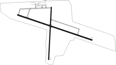
Runway 11 / 29  | ||
| length | 1552m (5092ft) | |
| bearing | 108° / 288° | |
| width | 23m (75ft) | |
| surface | concrete | |
| Runway 1 / 19 | ||
| length | 1037m (3402ft) | |
| bearing | 10° / 190° | |
| width | 18m (60ft) | |
| surface | asphalt | |
Nearby beacons
| code | identifier | dist | bearing | frequency |
|---|---|---|---|---|
| BIB | BIBLE GROVE VORTAC | 9.3 | 161° | 109 |
| SYZ | SHELBYVILLE NDB | 24.8 | 317° | 365 |
| MTO | DME | 27 | 31° | 109.40 |
| OLY | OLNEY NDB | 27 | 134° | 272 |
| VLA | VANDALIA VOR/DME | 29.3 | 272° | 114.30 |
| SAM | SAMSVILLE VOR/DME | 40.9 | 143° | 116.60 |
| GRE | GREENVILLE NDB | 41.6 | 254° | 233 |
| PLX | PALESTINE (ROBINSON) NDB | 41.7 | 94° | 391 |
| FWC | WAYNE CO (FAIRFIELD) NDB | 41.8 | 170° | 257 |
| AXC | ADDERS VORTAC | 42.7 | 334° | 117.20 |
| VNN | VERNON DME | 44.4 | 201° | 113.80 |
| LWV | DME | 47 | 108° | 108.80 |
| DE | ELWIN (DECATUR) NDB | 47.4 | 330° | 275 |
| ENL | CENTRALIA VORTAC | 48.8 | 224° | 115 |
| CM | VEALS (CHAMPAIGN/URBANA) NDB | 56.2 | 21° | 407 |
| CMI | CHAMPAIGN VORTAC | 59.1 | 15° | 110 |
Instrument approach procedures
| runway | airway (heading) | route (dist, bearing) |
|---|---|---|
| RW01 | CRATS (19°) | CRATS NOFSU (20mi, 24°) 2200ft |
| RW01 | NOFSU (10°) | NOFSU 2200ft |
| RW01 | SAM (323°) | SAM MUJRI (29mi, 316°) 2200ft NOFSU (5mi, 276°) 2200ft |
| RW01 | VLA (92°) | VLA COHKU (26mi, 112°) 2200ft NOFSU (5mi, 96°) 2200ft |
| RNAV | NOFSU 2200ft TIDVE (6mi, 10°) 2200ft 1H2 (5mi, 10°) 622ft (5337mi, 114°) 985ft NOFSU (5338mi, 294°) 2200ft NOFSU (turn) | |
| RW11 | BIB (341°) | BIB FISIX (18mi, 310°) 2500ft FISIX (turn) 2500ft |
| RW11 | MOBBY (222°) | MOBBY FISIX (19mi, 252°) 2500ft FISIX (turn) 2500ft |
| RW11 | UFJUV (96°) | UFJUV FISIX (13mi, 87°) 2500ft |
| RNAV | FISIX 2500ft FIBGO (5mi, 108°) 2300ft NAMVE (4mi, 108°) 1160ft 1H2 (2mi, 109°) 630ft (5337mi, 114°) 835ft JOVAR (5322mi, 294°) 2300ft JOVAR (turn) | |
| RW29 | JOVAR (283°) | JOVAR 2300ft |
| RNAV | JOVAR 2300ft OQOSE (10mi, 280°) 2300ft UNROJ (4mi, 288°) 1120ft 1H2 (2mi, 288°) 617ft (5337mi, 114°) 1800ft JOVAR (5322mi, 294°) 2300ft JOVAR (turn) |
Disclaimer
The information on this website is not for real aviation. Use this data with the X-Plane flight simulator only! Data taken with kind consent from X-Plane 12 source code and data files. Content is subject to change without notice.