Casey - Casey Muni
Airport details
| Country | United States of America |
| State | Illinois |
| Region | K5 |
| Airspace | Indianapolis Ctr |
| Municipality | Clark County |
| Elevation | 650ft (198m) |
| Timezone | GMT -6 |
| Coordinates | 39.30251, -88.00406 |
| Magnetic var | |
| Type | land |
| Available since | X-Plane v10.40 |
| ICAO code | 1H8 |
| IATA code | n/a |
| FAA code | n/a |
Communication
| Casey Muni CTAF/UNICOM | 122.800 |
| Casey Muni HULMAN Approach/Departure | 125.450 |
Nearby Points of Interest:
Greenup Commercial Historic District
-Thornton Ward Estate
-Cumberland County Courthouse
-Blakeman Bridge
-Harrison Street Bridge
-Health Education Building
-Old Main
-Pemberton Hall
-McFarland House (Charleston, Illinois)
-Sixth, Seventh, and Tenth Street Stone Arch Bridges
-Coles County Courthouse
-Will Rogers Theatre
-Alexander Briggs House
-Old Stone Arch
-Manly-McCann House
-John W. Lewis House
-Harlan Hall
-Robert L. Dulaney House
-First Congregational Church
-Philip D. Armour III House
-Fifteenth Street and Oklahoma Avenue Brick Street
-Railway Express Agency Building
-Unity Church (Mattoon, Illinois)
-Dr. Hiram Rutherford House and Office
-Richard Roytek House
Runway info
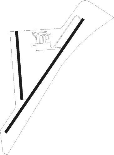
Runway 4 / 22  | ||
| length | 1220m (4003ft) | |
| bearing | 46° / 226° | |
| width | 23m (75ft) | |
| surface | asphalt | |
| Runway 18 / 36 | ||
| length | 593m (1946ft) | |
| bearing | 180° / 0° | |
| width | 23m (75ft) | |
| surface | grass | |
| displ threshold | 91m (299ft) / 0m (0ft) | |
Nearby beacons
| code | identifier | dist | bearing | frequency |
|---|---|---|---|---|
| MTO | DME | 16.8 | 302° | 109.40 |
| PLX | PALESTINE (ROBINSON) NDB | 24.1 | 129° | 391 |
| HU | YINNO (TERRE HAUTE) NDB | 28.6 | 82° | 245 |
| BIB | BIBLE GROVE VORTAC | 31.9 | 231° | 109 |
| OLY | OLNEY NDB | 35.9 | 196° | 272 |
| TTH | TERRE HAUTE VORTAC | 36.7 | 76° | 115.30 |
| LWV | DME | 37 | 143° | 108.80 |
| SYZ | SHELBYVILLE NDB | 39.4 | 277° | 365 |
| CM | VEALS (CHAMPAIGN/URBANA) NDB | 40.7 | 345° | 407 |
| CMI | CHAMPAIGN VORTAC | 45.7 | 340° | 110 |
| AXC | ADDERS VORTAC | 47.3 | 297° | 117.20 |
| SAM | SAMSVILLE VOR/DME | 49.2 | 186° | 116.60 |
| DE | ELWIN (DECATUR) NDB | 52.8 | 297° | 275 |
| FWC | WAYNE CO (FAIRFIELD) NDB | 58.5 | 204° | 257 |
| DNV | DANVILLE VORTAC | 63 | 24° | 111 |
| DN | JULIP (DANVILLE) NDB | 63.1 | 26° | 332 |
| VNN | VERNON DME | 67.8 | 220° | 113.80 |
Instrument approach procedures
| runway | airway (heading) | route (dist, bearing) |
|---|---|---|
| RW04 | FOXUK (46°) | FOXUK 6000ft FOXUK (turn) 2300ft |
| RW04 | MOBBY (84°) | MOBBY JEDGA (7mi, 115°) 2300ft FOXUK (5mi, 122°) 2300ft |
| RW04 | WORKE (309°) | WORKE KUTPE (14mi, 267°) 2300ft FOXUK (5mi, 302°) 2300ft |
| RNAV | FOXUK 2300ft COTGA (6mi, 46°) 2300ft 1H8 (5mi, 46°) 693ft (5312mi, 114°) 1055ft LUDJU (5305mi, 294°) 2500ft LUDJU (turn) | |
| RW22 | GAULS (187°) | GAULS LODPE (6mi, 161°) 2500ft LUDJU (5mi, 122°) 2500ft |
| RW22 | LUDJU (226°) | LUDJU 2500ft |
| RW22 | TTH (256°) | TTH IROGY (25mi, 260°) 2500ft LUDJU (5mi, 302°) 2500ft |
| RNAV | LUDJU 2500ft MASFY (6mi, 226°) 2300ft JONEP (3mi, 226°) 1260ft 1H8 (2mi, 227°) 694ft FOXUK (11mi, 226°) 2300ft FOXUK (turn) |
Disclaimer
The information on this website is not for real aviation. Use this data with the X-Plane flight simulator only! Data taken with kind consent from X-Plane 12 source code and data files. Content is subject to change without notice.