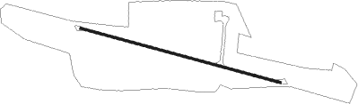
Freehold
Airport details
| Country | United States of America |
| State | New York |
| Region | K6 |
| Airspace | Boston Ctr |
| Municipality | Town of Greenville |
| Elevation | 437ft (133m) |
| Timezone | GMT -5 |
| Coordinates | 42.36400, -74.06503 |
| Magnetic var | |
| Type | land |
| Available since | X-Plane v10.40 |
| ICAO code | 1I5 |
| IATA code | n/a |
| FAA code | n/a |
Communication
| Freehold CTAF | 122.850 |
Nearby Points of Interest:
Woodward Road Stone Arch Bridge
-Prevost Manor House
-Henry T. Botsford House
-Greenville Presbyterian Church
-St. Paul's Lutheran Church
-Ford's Store
-L.E. Cleveland House
-Charles Pierce House
-A. T. House
-Mrs. Osburn House
-Oak Hill Methodist Episcopal Church
-Tripp House and Store Complex
-The Parsonage
-Torry-Chittenden Farmhouse
-Bear Swamp Preserve
-Allan Teator Road Stone Arch Bridge
-Potter Hollow District No. 19 School
-Union Chapel
-Alcove Historic District
-Hathaway
-Methodist Episcopal Church of Windham Centre
-Salisbury Manor
-All Souls Church
-Centre Presbyterian Church
-Newkirk Homestead
Nearby beacons
| code | identifier | dist | bearing | frequency |
|---|---|---|---|---|
| PFH | PHILMONT (HUDSON) NDB | 16.5 | 108° | 272 |
| ALB | ALBANY VORTAC | 25.7 | 34° | 115.30 |
| AL | HAWKY (ALBANY) NDB | 29.4 | 30° | 219 |
| HEU | HUNTER (SCHENECTADY) NDB | 30 | 15° | 356 |
| JJH | JOHNSTOWN NDB | 39.9 | 337° | 523 |
| DNY | DE LANCEY VOR/DME | 41.1 | 258° | 112.10 |
| PWL | PAWLING (POUGHKEEPSIE) VOR/DME | 41.2 | 142° | 114.30 |
| IGN | KINGSTON VOR/DME | 43.3 | 161° | 117.60 |
| CAM | CAMBRIDGE VOR/DME | 49.4 | 49° | 115 |
| SKU | STANWYCK (NEWBURGH) NDB | 50.2 | 179° | 261 |
| SW | NEELY (NEWBURGH) NDB | 53.2 | 191° | 335 |
| GF | GANSE (GLENS FALLS) NDB | 57.2 | 27° | 209 |
| HUO | HUGUENOT VOR/DME | 61.9 | 209° | 116.10 |
Disclaimer
The information on this website is not for real aviation. Use this data with the X-Plane flight simulator only! Data taken with kind consent from X-Plane 12 source code and data files. Content is subject to change without notice.