Fulton
Airport details
| Country | United States of America |
| State | Kentucky |
| Region | |
| Airspace | Memphis Ctr |
| Municipality | Fulton County |
| Elevation | 398ft (121m) |
| Timezone | GMT -6 |
| Coordinates | 36.52570, -88.92466 |
| Magnetic var | |
| Type | land |
| Available since | X-Plane v10.40 |
| ICAO code | 1M7 |
| IATA code | n/a |
| FAA code | 1M7 |
Communication
Nearby Points of Interest:
Jesse Whitesell House and Farm
-W.W. Morris House
-Mt. Zion Colored Methodist Episcopal Church
-Deering Building
-Obion County Courthouse
-Hickman County Courthouse
-Marvin College Boys Dormitory and President's House
-William Parker Caldwell House
-Dickey's Octagonal Barbershop
-Carnegie Library
-Thomas Chapel C.M.E. Church
-Wooldridge Monuments
-Big Oak Tree State Park
-Bardwell Illinois Central Railroad Station
-Ballard County Courthouse
-Trimble House
-Caldwell-Hopson House
-Aquone
-Edwin S. Diuguid House
-First Christian Church
-Calloway County Courthouse
-First Baptist Church
-Pete Lyles House
-Old Custom House
-Cairo Historic District
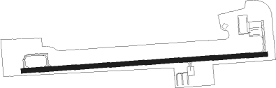
Runway info
| Runway 9 / 27 | ||
| length | 1217m (3993ft) | |
| bearing | 90° / 270° | |
| width | 23m (75ft) | |
| surface | asphalt | |
| displ threshold | 0m (0ft) / 49m (161ft) | |
Nearby beacons
| code | identifier | dist | bearing | frequency |
|---|---|---|---|---|
| UC | OBION (UNION CITY) NDB | 14.1 | 197° | 212 |
| CNG | CUNNINGHAM (PADUCAH) VOR/DME | 29.3 | 10° | 113.10 |
| EU | MUREY (MURRAY) NDB | 32.7 | 73° | 368 |
| CIR | CAIRO NDB | 35.2 | 331° | 397 |
| DYR | DYERSBURG VORTAC | 35.9 | 218° | 116.80 |
| MAW | MALDEN VORTAC | 47.6 | 272° | 111.20 |
| CGI | GIRARDEAU DME | 52.3 | 317° | 112.90 |
| MKL | MC KELLAR (JACKSON) VOR/DME | 55.3 | 179° | 112 |
| CG | DUTCH (CAPE GIRARDEAU) NDB | 57.4 | 313° | 248 |
Disclaimer
The information on this website is not for real aviation. Use this data with the X-Plane flight simulator only! Data taken with kind consent from X-Plane 12 source code and data files. Content is subject to change without notice.