Salisbury - Bennett
Airport details
| Country | United States of America |
| State | Maryland |
| Region | |
| Airspace | Washington Ctr |
| Municipality | Wicomico County |
| Elevation | 41ft (12m) |
| Timezone | GMT -5 |
| Coordinates | 38.41561, -75.61747 |
| Magnetic var | |
| Type | land |
| Available since | X-Plane v10.40 |
| ICAO code | 1N5 |
| IATA code | n/a |
| FAA code | 1N5 |
Communication
Nearby Points of Interest:
Spring Hill Church
-Gillis-Grier House
-Poplar Hill Mansion
-Union Station
-Perry-Cooper House
-F. Leonard Wailes Law Office
-Maude R. Toulson Federal Building
-Sen. William P. Jackson House
-St. Giles
-Stanley Potato House
-San Domingo School
-Asbury Methodist Episcopal Church
-Phillips Potato House
-Dickerson Potato House
-Laurel Historic District
-Bounds Lott
-Spring Garden
-Rider Potato House
-Chipman Potato House
-Chipman's Mill
-Old Christ Church
-Bennett's Adventure
-Bethel Historic District
-White Hall
-Handsell
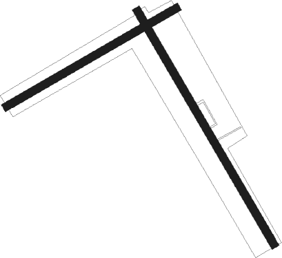
Runway info
Runway 17 / 35  | ||
| length | 967m (3173ft) | |
| bearing | 148° / 328° | |
| width | 29m (95ft) | |
| surface | grass | |
| Runway 08 / 26 | ||
| length | 701m (2300ft) | |
| bearing | 69° / 249° | |
| width | 29m (95ft) | |
| surface | grass | |
Nearby beacons
| code | identifier | dist | bearing | frequency |
|---|---|---|---|---|
| SBY | SALISBURY VORTAC | 6.5 | 123° | 111.20 |
| OX | LANDY (OCEAN CITY) NDB | 20 | 97° | 407 |
| SWL | SNOW HILL VORTAC | 22.7 | 157° | 112.40 |
| ATR | WATERLOO VOR/DME | 30.3 | 46° | 112.60 |
| PXT | PATUXENT (PATUXENT RIVER) VORTAC | 37.6 | 261° | 117.60 |
| NHK | PATUXENT NDB | 37.8 | 261° | 400 |
| NHK | NAS PATUXENT RIVER TACAN | 38.2 | 260° | 110.25 |
| DOV | DOVER TACAN | 43.6 | 12° | 110 |
| ENO | SMYRNA (KENTON) VORTAC | 49.2 | 7° | 111.40 |
| SIE | SEA ISLE VORTAC | 55.9 | 50° | 114.80 |
| MTN | MARTIN (BALTIMORE) TACAN | 66.3 | 319° | 134.10 |
Disclaimer
The information on this website is not for real aviation. Use this data with the X-Plane flight simulator only! Data taken with kind consent from X-Plane 12 source code and data files. Content is subject to change without notice.